Bikepacking brings out the spirit of exploring, the desire to find areas not accessible by motorized vehicles, to ride challenging terrain in all kinds of weather, and forces you to be present, which helps you forget daily worries. When you mix in waterfalls the adventure is much more grand. Northeastern Wisconsin is a great place to plan such adventures by bike. The roads are remote, and you rarely see a car. The falls are numerous and often overlooked.
No big parking lots full of cars with these waterfalls. Most often you will be the only person at the falls, making it easy to spend a little extra time enjoying the sounds and solitude of that moment, take a dip in the deep, cool pools, or photograph that moment with just the falls in the background. For these reasons I find the falls in this area of the state to be a different experience compared to the more popular falls in the northwestern part of the state.
Trip planning and bike choice
Each year for the past three years I have planned a new waterfall route and invited a few of my friends to go out and find these new waterfalls. To find the falls I use resources such as looking through publications on the web such as gowaterfalling.com, to find the more popular falls and use map layers on ride with gps to locate some unknown falls or other points of interest that are close by. To connect roads and trails to these falls I use as many unpaved options as possible while still routing through small towns for resupply and eat at local restaurants and taverns.
My ideal route will contain numerous two track and singletrack trail sections. The 2021 route through Northeastern Wisconsin fit these criteria perfectly; a bonanza of deep sand forest roads, a couple sections of singletrack in the Iron Mountain area, plenty of gravel, and connections to small towns that the majority of people never take the time to stop and check out.
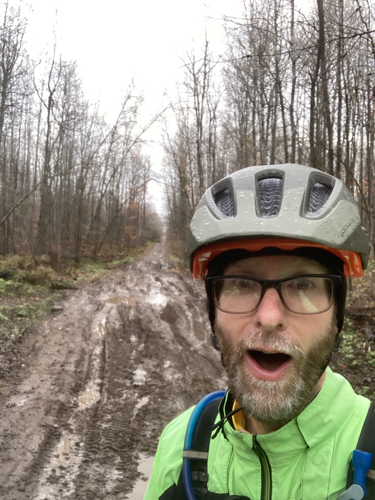
While the route was dialed, Mother Nature made the adventure a little more challenging for the three of us on this year’s waterfall trip. The forecast called for off and on rain through the three late August days of our trip. Getting wet from a warm late summer rain wasn’t the concern but it could make the soft gravel roads and miles of sand sections slow going. For this reason I chose to ride my fat bike with 4” tires while Chris Schotz and Candace Jenkins brought bikes fitted with 2.7” tires. This proved to be a good choice as the first day was light rain for most of the ride. Sand on this route, especially scattered throughout the first 165 miles, was plentiful and our setups made going through it a breeze and so much fun. Chris and Candace had to lower the pressure on their narrower tires once we reached the deep sand roads, while I ran a firm 16-18 psi on my four inch tires.
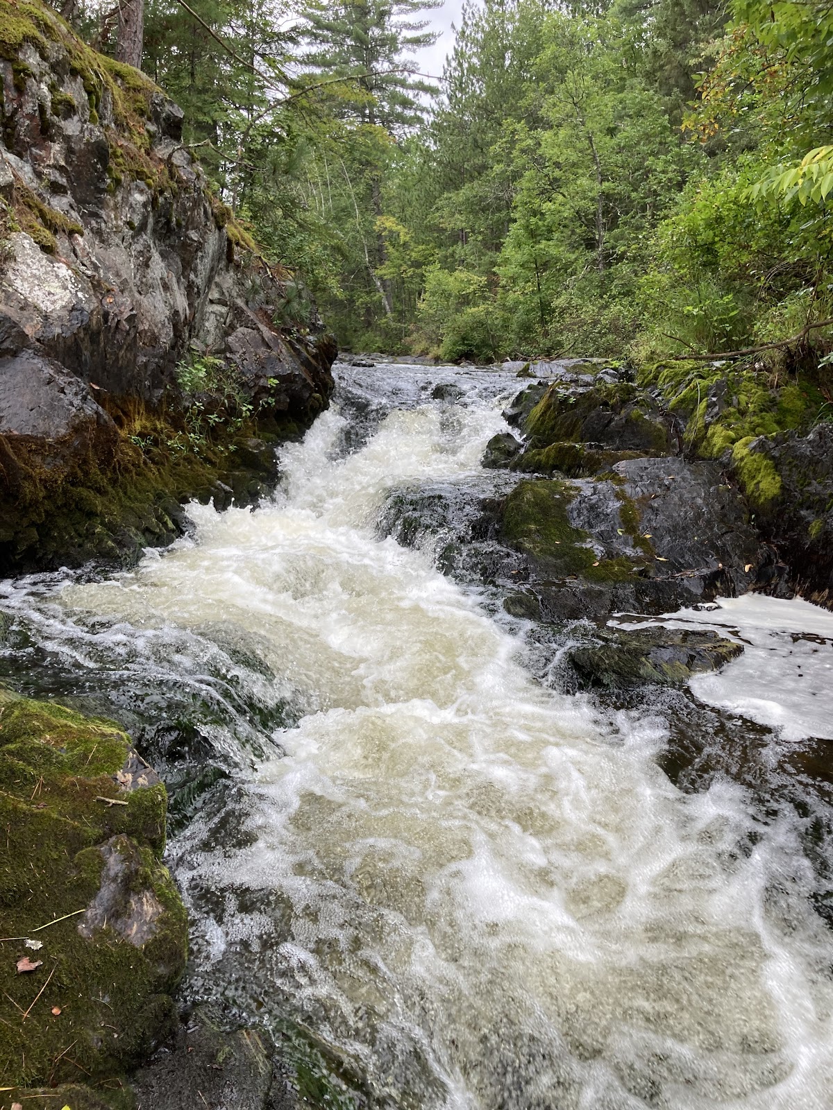
And then there was forest road 608 on the last day and what seemed like it’s unending nearly hub deep puddles from the heavy storm that rolled through the previous night. That was followed by a long climb out on a two track of baby head rocks. And between all that was the singletrack in Niagara and Iron Mountain. Bikepacking with a fat bike can make the singletrack a chill affair.
One of the more memorable moments of the trip that would not have happened if we were on narrower gravel tires was the three of us racing as fast and hard as we could through Spread Eagle Barrens. That place is all sand and hills with some fun corners. At the end of that three mile section we were drenched with sweat and laughing so hard. An amazing memory for sure!
The waterfalls
The route consists of 15 waterfalls and three sections of rapids. We started out in the rain on the first day, so we skipped McClintok Park and Strong Falls. Both are interesting places to see, especially McClintok Park with all its bridges but since we all had seen those places on past trips we chose to save the time thinking we might need it. After all, frequent stops to view waterfalls takes a lot of time.
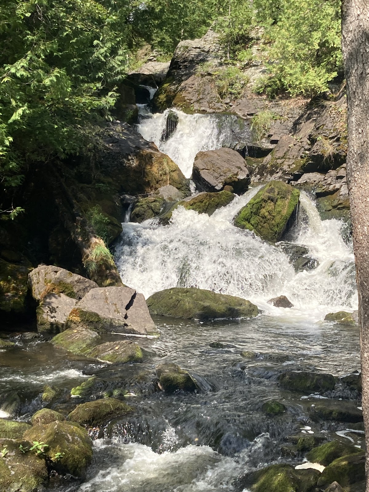
The first falls we visited was an unnamed waterfall. The sand forest road leading to it soon turned to two track, which eventually became a seldom used hunter track. We came to a dead end with a loop where trucks turned around. The height of the grass told us that no one had been there in a very long time. We were between a quarter and a half mile from where I marked it on gps, a marker I placed from being able to visibly see the falls through satellite imagery. No trail through the forest and no audible sound of the falls could be heard but we did see two red ribbons tied to trees as we bushwhacked our way through. Someone at some point had marked it for future reference. Soon we started hearing the rush of the water and knew we were on the right track. When we came to it we were in awe. The combination of the beauty of the falls and knowing we were three of the very few people that made it back there to witness it was very rewarding. Being the adventurous soul that Chris is ,he jumped in the river to get a better picture of the falls as he did so many times on the trip.
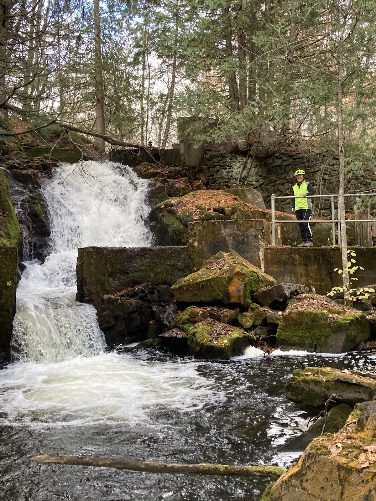
Dave’s Falls, Bull Falls, and Horseshoe Falls were next in the route. After that was Twelve Foot Falls and Eight Foot Falls where we watched a guy raft over after he drank a Hamm’s beer. Eighteen Foot Falls was just down the road from there, which is an impressive falls that requires a short hike to get to. Five miles down the road we came to a bridge where far below is the impressive Carney Rapids which has a log lengthwise jammed in it. We all think that the log looks axe cut and wonder if it is from that era in time.
Someone driving through in a car might miss this impressive canyon but by bike more of your senses are alert and you hear the rapids rushing below. Right next to the rapids a dead end takes you to Four Foot Falls. The road to the falls is an amazing site and as Candace said at the time, “it seems like we’re riding through a jungle”. Sometimes the roads in these remote areas are so remarkable and in that moment there is no place that can compare. The river is rushing to our right on the way in and we notice small waterfalls every so often. At the end of the road is a small hiking trail consisting mostly of a new boardwalk that leads to the falls. This falls is not large but has a unique drop to the side caused by a large crevice in the rock running lengthwise with the stream.
Twenty six miles later we came to Long Slide Falls. This is an impressive falls with its height and rock formations. Just up the road a mile or two is Smalley Falls, my favorite of the route. This falls makes you feel like you’re in the jungle with its trees and ferns growing out of the side. You can actually climb down and easily get right into the falls and even take a dip in the deep pool at the bottom as Chris did.
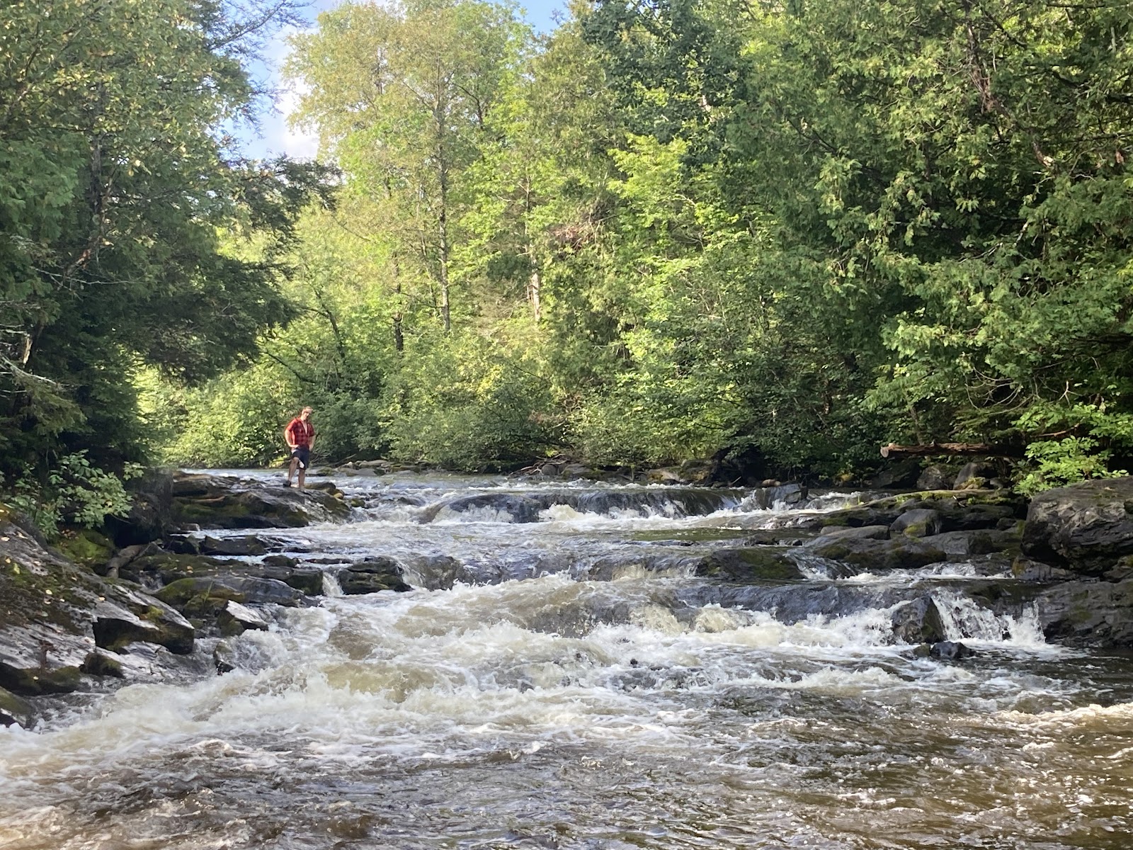
After we crossed the border into Michigan and rode the singletrack, we sat on the rocks with our bikes laying next to us to look at Piers Gorge while eating some snacks we brought from the previous town. Candace and Chris were splitting a pancake that they brought from the diner earlier that day. I had some toast from that diner and squeezed the jelly packets on it that I grabbed from the diner table. Ordering extra food at stops is a great idea and makes for memorable picnic moments like this one.
From there we rode a few miles to the roadside Fumee Falls, a small but beautiful falls. We skipped Pine River Falls so we could make it to camp before dark but the next morning was an early visit to LaSalle Falls. This is the largest drop in the area with a 20’ plunge and the longest hike on a well worn trail which was a mile in. Shortly after is the last remaining falls, Washburn Falls, a small drop on a wide and wild river that then becomes calm and tranquil. Having a long distance between services we filtered water at this spot out of the crystal clear Popple River, a fitting way to say goodbye to the last of the falls of the trip.
Food and Camp
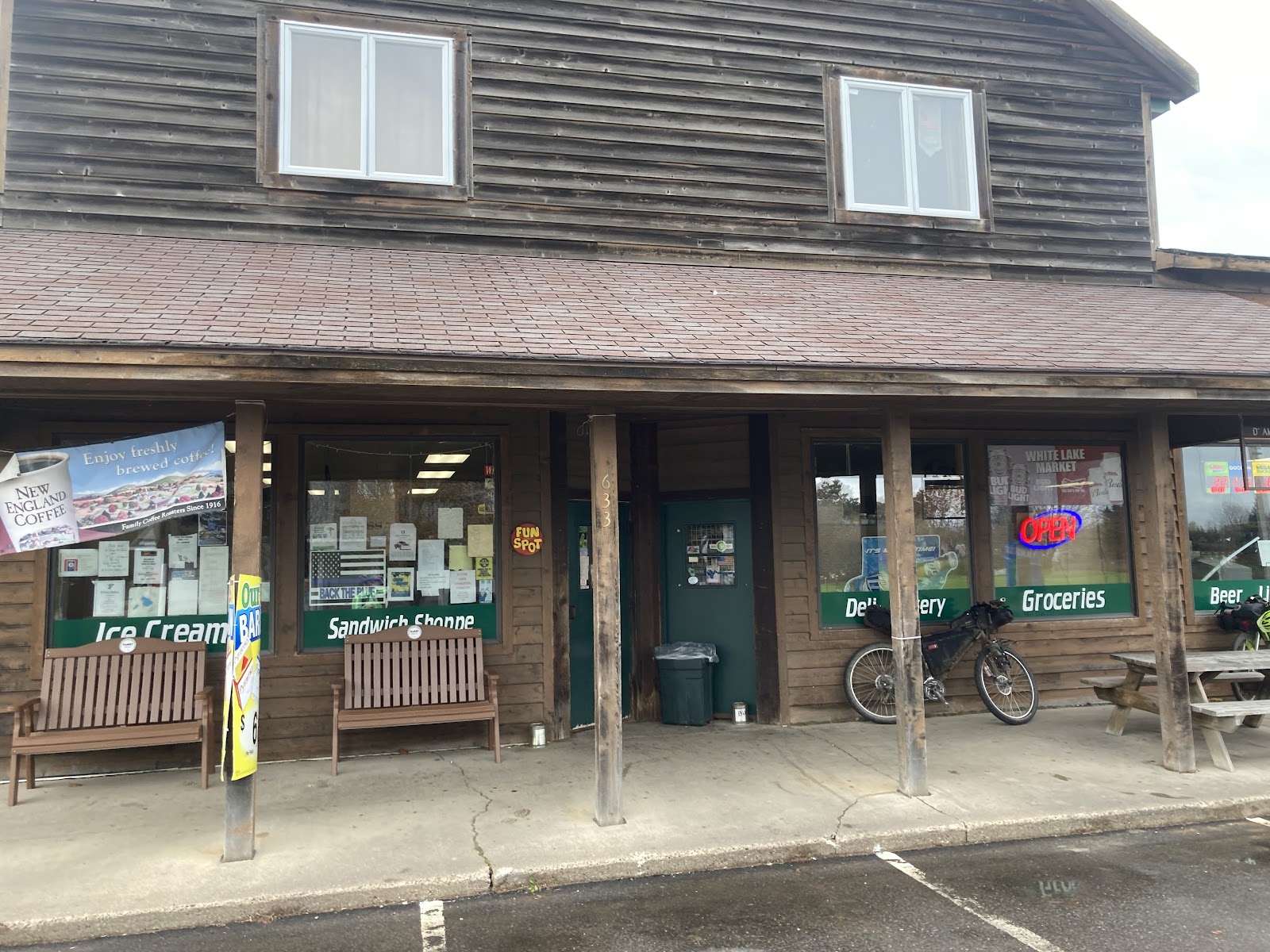
Some of my favorite places to eat are restaurants, taverns and cafes in small towns that I find while bikepacking. For example, over the years I’ve come across places that smoke their own meat, places with amazing lake views, places where I talk to the owner like we know each other, and just good old fashioned diners. Candace has a good rule of thumb when it comes to finding local favorites; go to the place with the most cars in the parking lot.
Winter’s Family Restaurant, a small local diner in Pembine was an incredible place for breakfast. This place was close enough to camp at only 20 miles out. It was nice to not have to cook breakfast that morning at camp. I eat a lot and this place doesn’t skimp on the portions or the flavor. I ordered their special of the day, a giant skillet which was smothered in gravy. Candace ordered two of the biggest pancakes I’d ever seen, so big that she only was able to eat a third of them. Chris ordered a giant omelet. We are still not sure how many eggs were in it.
The hospitality Up North is always top notch. Winter’s went through the trouble of packing up the remaining of Candace’s pancakes in foil and then ziplock bagged it so she could take it on the bike! She said it made a great afternoon lunch for her and Chris to share. I ended up bagging up my toast and grabbing a couple jelly packets off of the table for my afternoon lunch.
On the way out we got stopped by two guys asking about our trip. They ended up being from the Iron Mountain area and told us the best way to ride the singletrack at Piers Gorge. Other than gas station food the only other place we stopped for a meal was 51st State Brewing. The place just got a new pizza oven so we ordered a pizza to share. Paired with a couple beers this was a satisfying stop. The pizza was delicious and the beer went down easy after a long hot day in the saddle.
As for camping, we spent two nights. The first night was at Twelve Foot Falls campground. They have about 15 sites and we actually were lucky enough to get the last one that was available. The best thing about that campground is listening to the falls while falling asleep. The second night we had to really push it to make it to our planned camp spot before dark. This place was on a slow moving part of the Pine River right before the dam and was a small three site dispersed style campsite. The amazing part about our night here was a completely clear night, viewing the Milky Way, and watching lightning storms roll through for the entire evening just to the north of us. No campfire was needed. During the overnight we did have some pretty crazy storms roll through with some heavy winds. It only lasted a half hour but it sure added a bit of excitement to the night.
There are a few other campgrounds that I labeled on the Ride With GPS map, most notably Bear Lake National Forest campground, Goodman Park County Park, Morgan Park campground, and East Bass Lake campground.
https://ridewithgps.com/routes/35857772
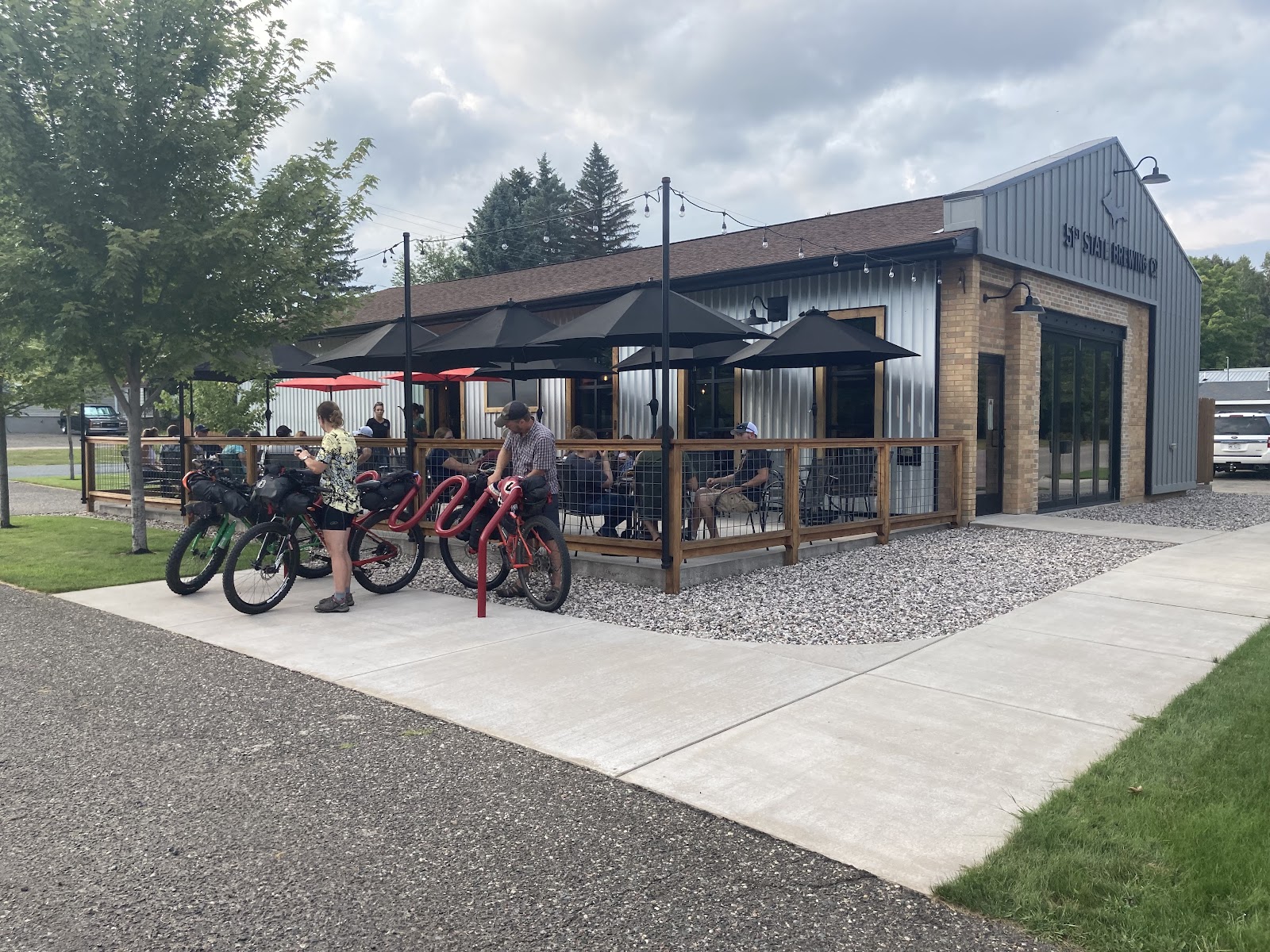
51st State Brewing makes amazing fire oven pizza and comfortable atmosphere either inside or outside.
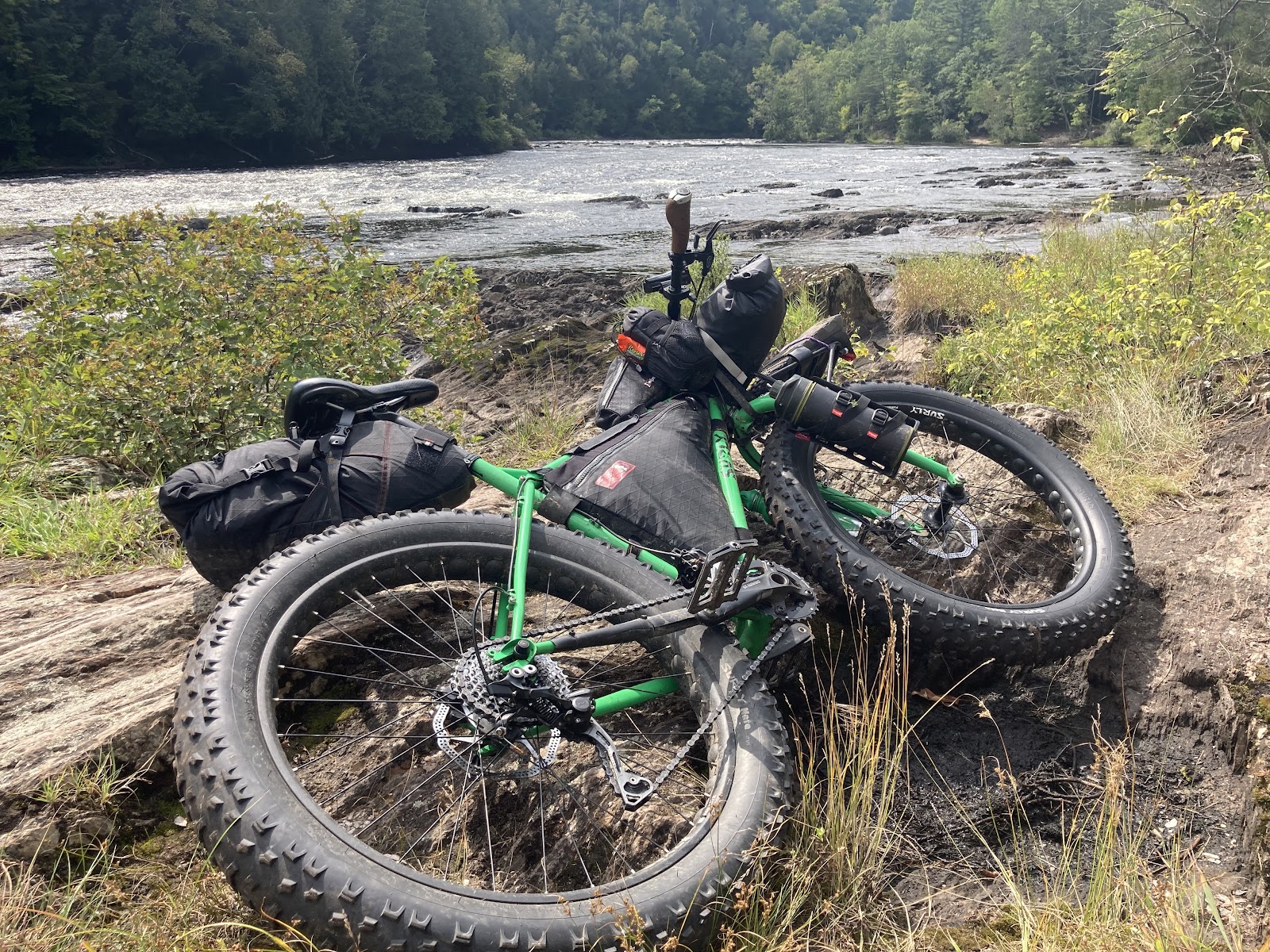
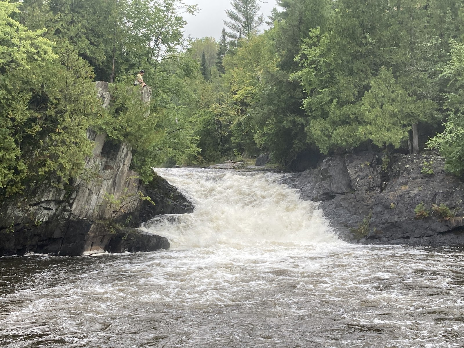
Enjoying a moment at Piers Gorge on the Menominee River
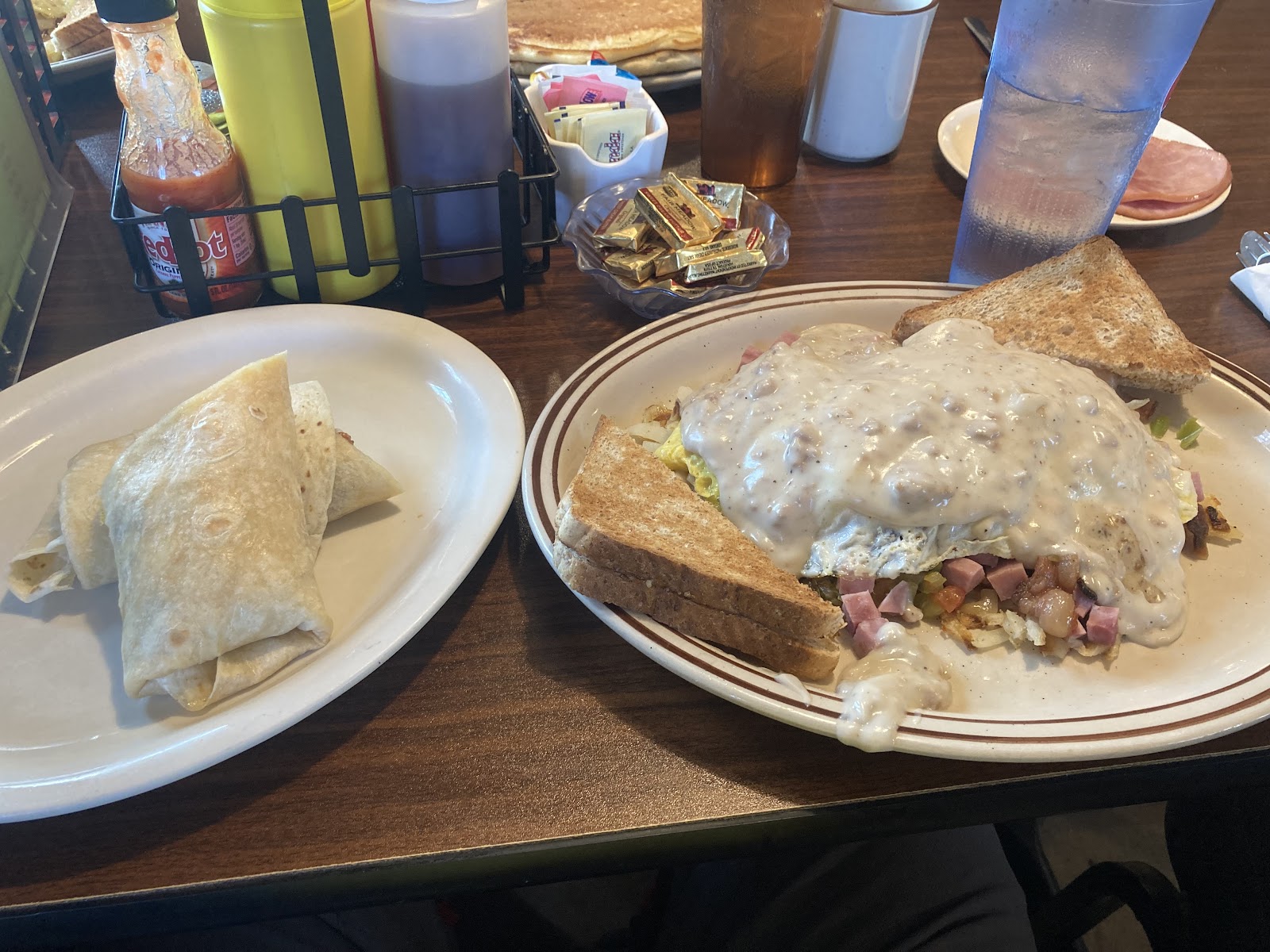
Breakfast at Winter’s Family Restaurant. The skillet and a breakfast burrito is what it takes to fill me up!
Unnamed falls that we bushwhacked to find

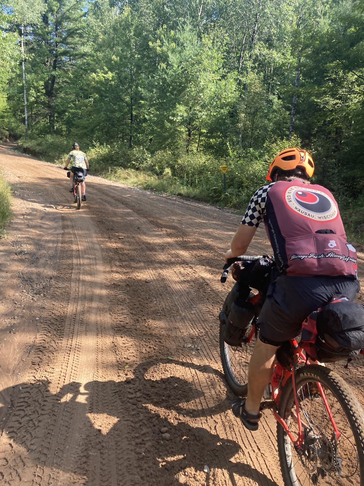
Riding the sand roads of Marinette County

Our campsite on the Pine River
Long Slide falls
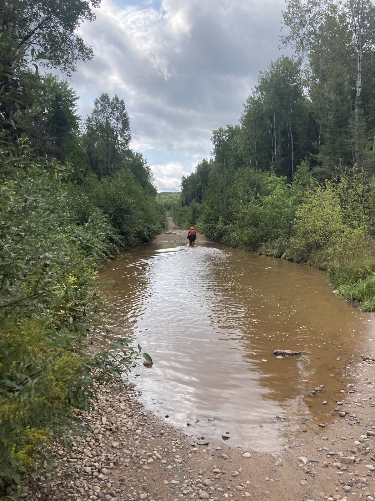
Water holes of Forest Road 608
The impressive LaSalle falls
In between the rain we had some very nice weather

The Batty Millie beer, a wheat beer with hints of blueberries, at 51st State Brewing named after Millie Bat cave in Iron Mountain.
Washburn Falls, our last falls of the trip.