
The Sky Island Odyssey is a bikepacking route masterpiece created by Sarah Swallow. It is in the extremely biodiverse region of the Sonoran desert in the borderlands of southern Arizona that takes you through the Santa Rita Mountains. The route not only transports you through a beautiful, unique and diverse place but also, in stark contrast, a place that bluntly shows you the harsh reality of immigration and the humanitarian, empathetic aspect of it.
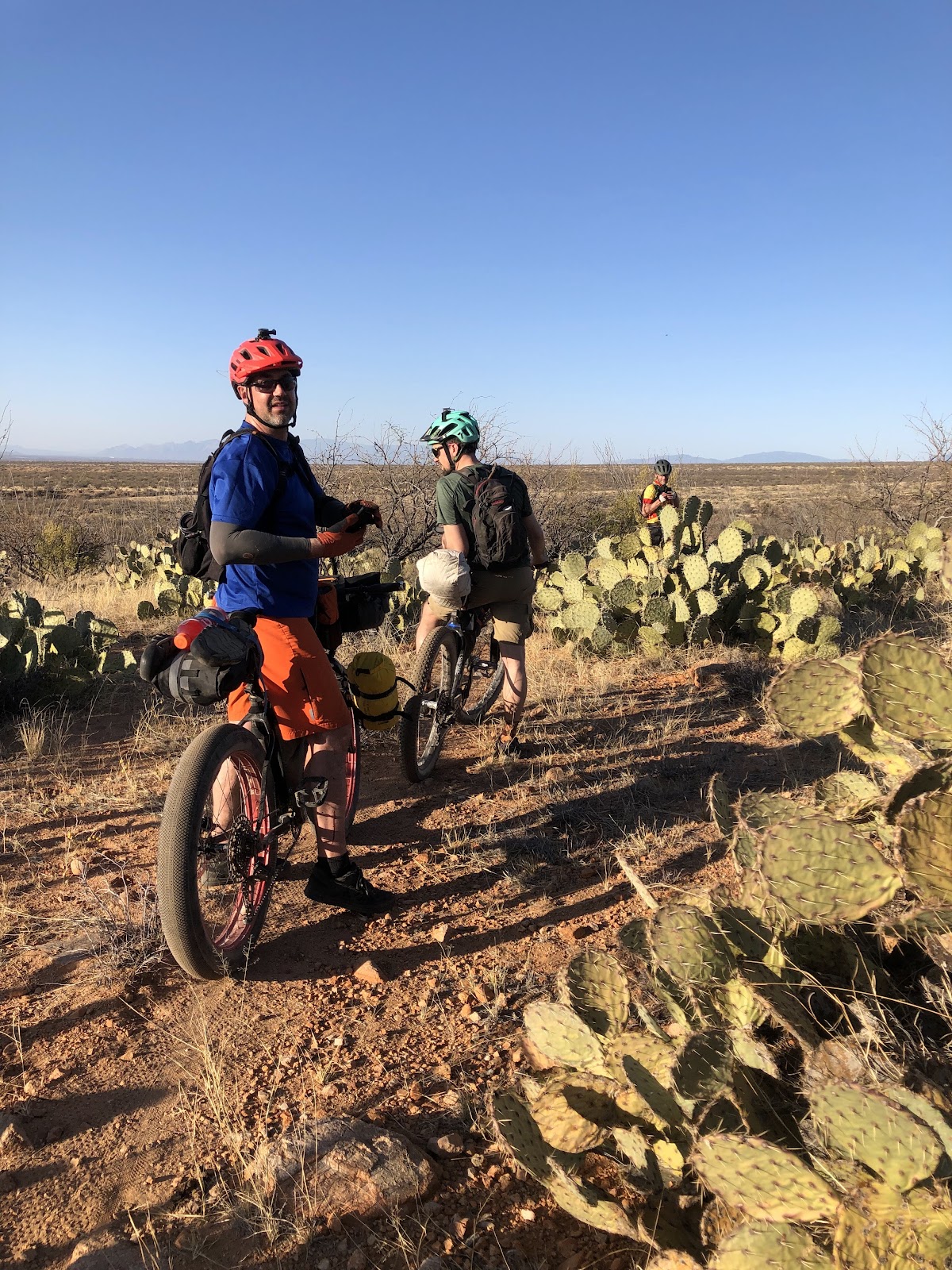
After more than a year of planning and excitement our day had finally arrived to embark on our five day Sky Island Odyssey bikepacking adventure. It was a small group of close friends. Myself, Chris Schotz, Candace Jenkins, Eric Simkins and David Lieble, all of us very unfamiliar with the harsh, dry environment of the remote southern Arizona desert. A route that would test all of us in different ways and push each of us to our limits. The route itself, which Sarah said should be given five days to complete, had only one resupply point each day and on top of that I added some difficult additions, the relentless and rugged Elephant Head singletrack trail for Wednesday and 14 miles of Arizona Trail for Friday.

As for my setup, I was running with less gear than I usually run, a lighter 55 degree sleeping bag, no cook set, and carrying only 1300 calories per day. Most of my weight I was carrying was in water with four and a half liters.

The artsy if not eccentric town of Patagonia, the town in which we saw javalinas meandering through the park the night prior, was our starting point of our ride on the very cold mid March Monday morning. None of us were expecting 24 degrees when we woke up from our tents at TerraSol base camp but as soon as the sun crested the beautiful mountains surrounding Patagonia we could immediately feel its warmth.
After a quick breakfast at Wagon Wheel Saloon in Patagonia we were off. A very short jaunt from town took us off of pavement and onto gravel, slowly pushing our loaded bikes up the steady 2,000 foot climb out of town. Sleeves quickly came off as the climb and that strong spring sun warmed us. I don’t think anyone even noticed how long and steady that climb was but instead we were all taking in all the newness that was surrounding us. An environment that was so foreign to what we were used to. We didn’t know at the time that this environment would be a constantly changing environment throughout our week.

Tall old growth oak trees lined the road, a road that was winding along a dry river bed, one of many dry river beds in the area. After talking to Cristina at the Appleton Whittell Research Ranch we found out that the monsoon season runs in the summer months when, each summer those river beds would be full and sometimes overflowing onto the roads.
After a ridiculously steep section and 20 miles in we finally reached the summit. We were treated with one of the best views on the entire route, one that I’ll never forget.
We took in the view for some time, jumping off our bikes and climbing up rocks like kids to reach the highest possible point before jumping back on our bikes and descending the steepest and longest descent I’ve ever done. Part way down Eric said he smells breaks. We look at our rotors and they are a blue/purple color, an indicator of just how hot they were getting. I spit on mine. Hiss! I said yep they’re pretty hot. Descending a little further we encountered four off road jeeps churning up the hill on what looked like an impossible climb for even the burliest 4×4. Once we reached what looked like the bottom, looking back at the mountain we just came down, it was still a long, gradual, washboard riddled descent all the way to Rio Rico, our only resupply of the day, Wendy’s. Not the greatest of places to eat but the frosties were delicious as the temperature soared to around 80. The interesting thing about Rio Rico is it’s close proximity to Mexico which meant that the road signs are in Spanish and the speed limit is in kilometers.
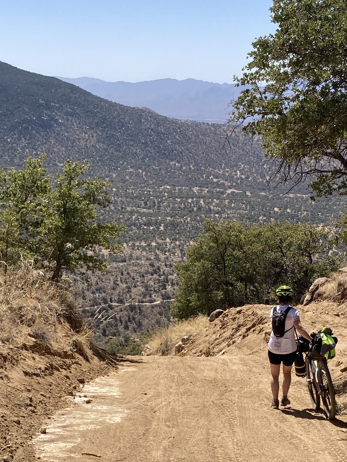
After our meal we crossed the super busy freeway, the only really busy spot on the route and one of the last times we’d see people for the remainder of the day. A few more miles of blacktop and a super fun paved down hill led us to the turn off for Peña Blanca Lake. Skipping the lake because we wanted to push as far as we could today we continued onto the start of the gravel. The landscape changed to more rolling hills with constant punchy climbs and downhills which could not be taken with much speed because of the rough washboards.

Weaving our way through the mountains along cliff edges with a backdrop of mystical hills in every direction made for frequent stops to take it all in making the hills slightly less draining but brutal nonetheless.

The beauty of it all was surreal, a sharp contrast to the occasional abandoned tire drags left abandoned by border patrol once the chains that attach the drags to their vehicle breaks and the black gallon water bottles left for immigrants who try to stay invisible to the agents while making the long and difficult journey through the Sonoran desert. It made us realize how difficult a journey they must have when it is this difficult for us with our way of transportation and food and water we are carrying.
With the sun getting lower it was time to find our first camp of the trip. When you’re bikepacking the sun kind of becomes your clock, your only real measure of time. We started scanning the sides of the road for a large, flat area, stopping every so often and debating a few spots until we came to the most amazing open spot on the outside edge of a curve. We went about 30 or 40 yards off of the road and each picked some flat spots to set up our tents. As we were setting up camp a cow came over and started licking a mineral block that none of us even noticed.

A few moments later an entire herd came in, the thud of their hooves catching our attention. As we ate our dinner for the evening the cows enjoyed theirs paying no attention to us. The moon was bright, super bright like a Wisconsin full moon on a winter’s night of new snow. We could see the herd still meandering around that mineral block only 20 yards from us, the thuds from their hooves a constant throughout the time. Soon they laid down for the night just as we did. It was kind of a special treat to be sleeping in such a spot alongside that herd. Around 4am I heard those thuds of their hooves once again as they got up to leave, moving up into the hills.
Tuesday morning in the low valley of our camp created a sunrise cast bright against the canyon walls to the west of us. I got my kit packed up before everyone else and I rode up the gravel road to the top of the hill so that I could catch the sunrise. A few cows were grazing in the long grass across the way. A border patrol truck came up and over the hill paying no attention to me. After a few minutes of quiet stillness I rode back down to the camp and met up with the group. We pedaled out of camp heading towards Ruby ghost town. The giant barrel cactuses with their yellow flowers on top dotted the landscape, another change to our environment.
A few really nice campsites were alongside the road in the area of Ruby ghost town and the gravel was noticeably smoother in this area. Not long after we came to super smooth asphalt which led us on a long downhill into the tiny town of Arivaca. This was an out and back trip to get our resupply for the day. Once in town we pedaled a long climb uphill to the cafe which ended up being closed. Back down to town and we stopped at Arivaca Mercantile where we grabbed some lunch consisting of a ton of fresh produce, sandwiches, a jar of pickles to split between us and chips. I picked up some fresh fruit to put in my jersey pockets. Someone spotted a picnic table outside behind the store so we grabbed it. A water hose was off to the side and made the perfect spot to wash out shammies and clean up ourselves a little. You take what you can get out there and this was a true gift from the gods. While eating, a couple came back and talked with us. They had seen us yesterday at Wendy’s and talked to Candy about our trip. What a huge coincidence to run into them again. They were actually from Minnesota and were spending the winter in southern Arizona.
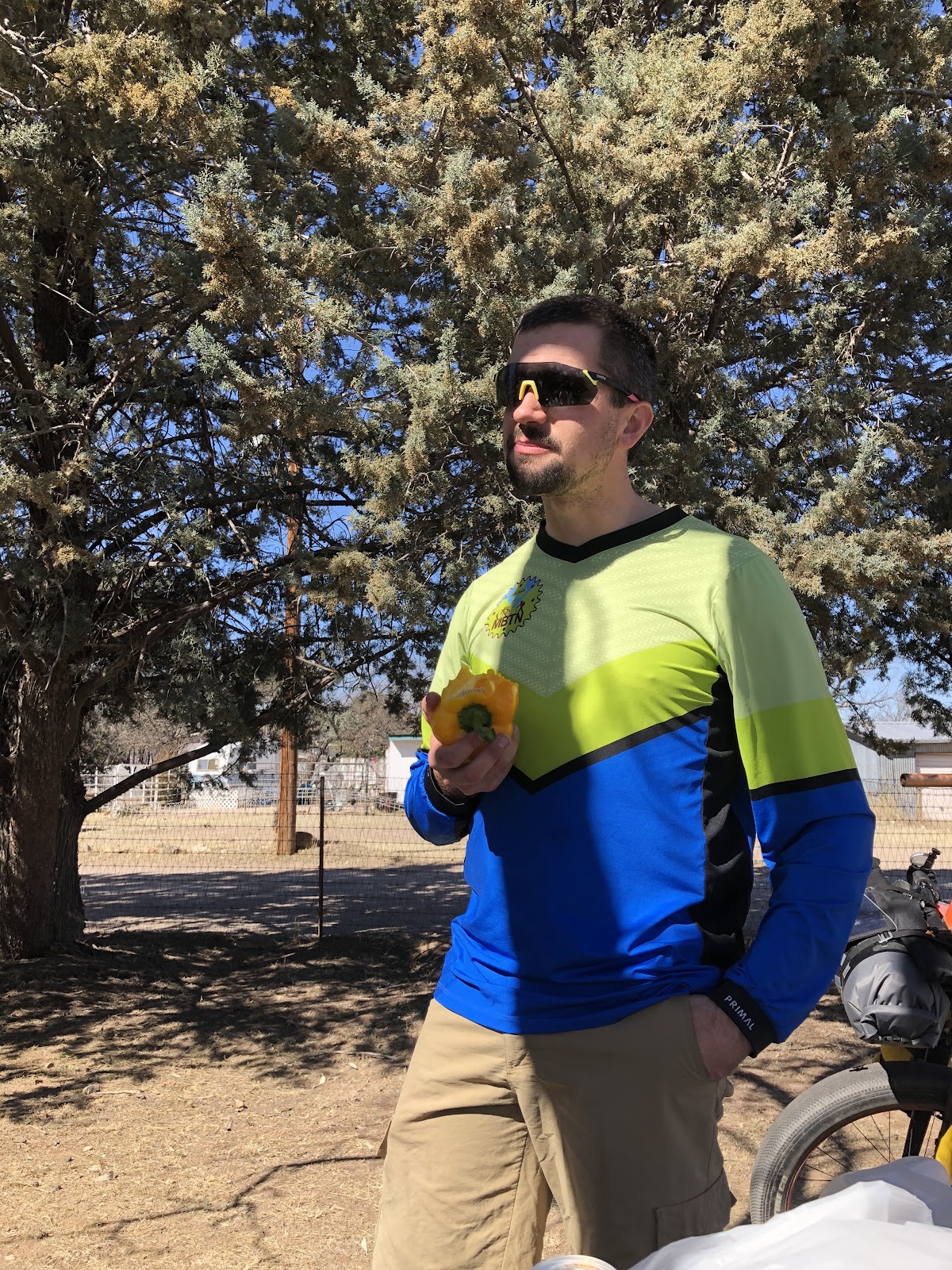
After stuffing some fresh fruit in my jersey pockets, something I never went without having on this trip, we set off towards Buenas Aires National Wildlife Refuge. Outside of town a roadrunner ran across and as I took out my phone to snap a picture I noticed I had service. It was my son’s birthday so I was so happy to be able to call him and wish him a happy birthday.
Getting back on to gravel just outside of town I started to feel kind of weak and some bonking coming in. I slowed and David and Eric stayed with me, noticing me struggling. We stopped and rested under a shade tree. I downed some Tailwind. That stuff really works fast as I recovered pretty quickly.
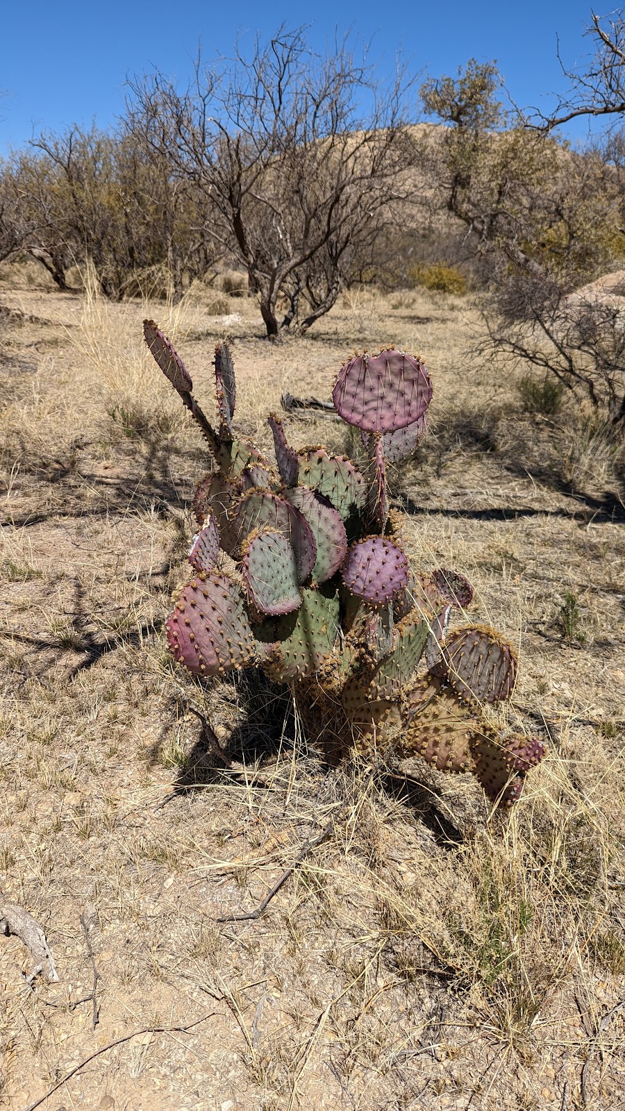
Jumping back on the bikes we made our way through some more interesting environments as things started to change yet again. More cactuses dotted the landscape as the terrain somewhat flattened. Not so many punchy climbs. The most interesting of the cactus were the jumping chollas and the very odd purple colored Santa Rita prickly pear.
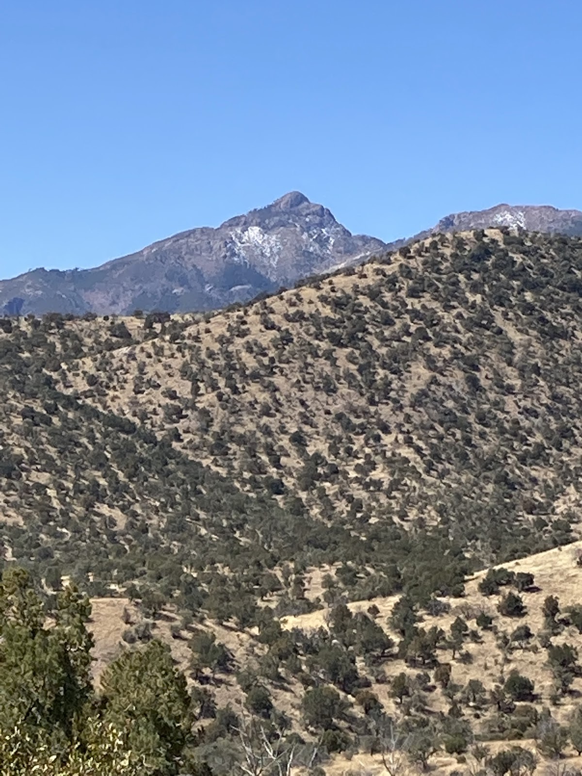
The Boboquivari Peak also started to appear in the distance and we’d be able to see this peak for the next day and a half.

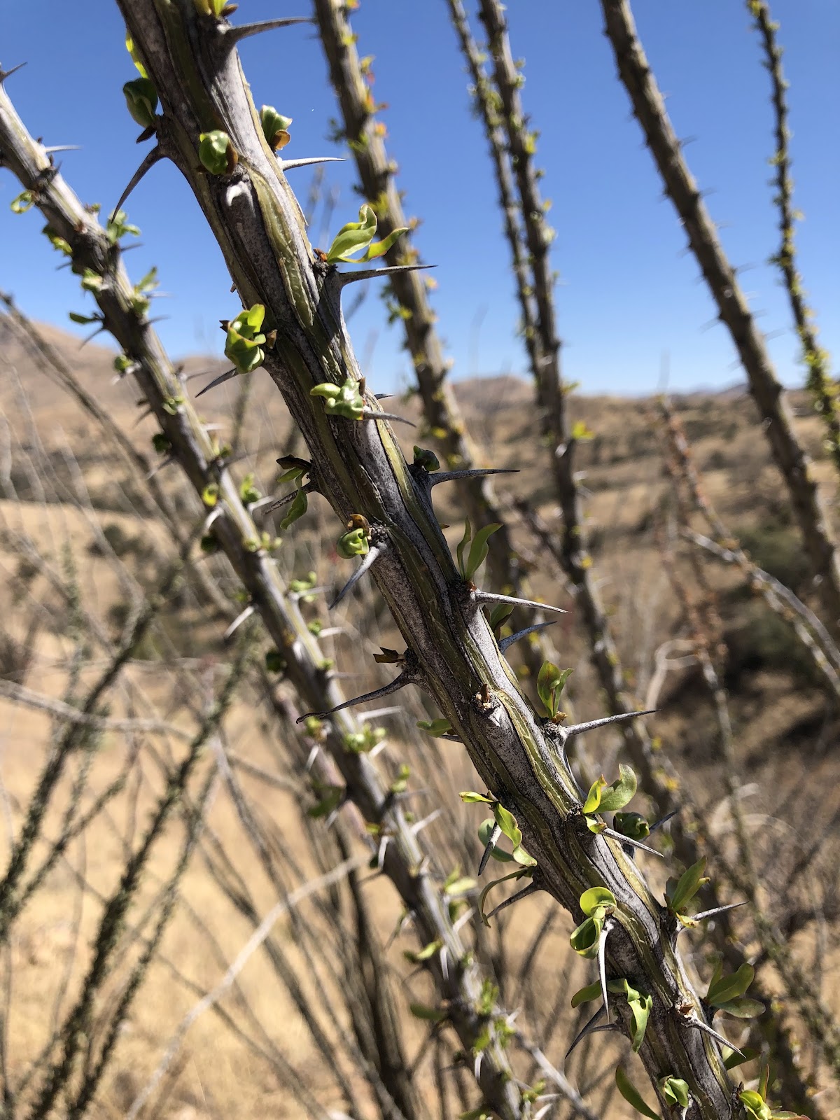
Even more otherworldly plants started popping up in this area, the oddest being the ocotillo, a tall cane like plant with no branches and sharp, thick spines that poke out of it. Lifespan of these odd shrubs is 60-100 years.
While all of this was happening with me stopping and us taking in all the beauty we realized that we had gotten separated from Chris and Candy. Luckily we, at one point, had service and found out that they took the route down to the border wall, an extra 15 miles for them.
After we realized they were safe and we’d all eventually meet up again at some point we enjoyed our jaunt through this area of many varieties of cactus, jumping in and out of dried creek beds and our steady pace in the direction of Boboquivari Peak. The terrain was continuing to flatten and we came to a point where we could see the visitor center at the wildlife refuge far below us. We had a fast descent to the refuge on a smooth gravel road. The visitor center was an amazing stop to fill up with water and sit in the shade, allowing Chris and Candy to make up some ground on our gap between them. It was such an amazing day with sun that wasn’t too hot and a very light breeze. Perfect for relaxing at the visitor center. I think we may have sat there for over an hour but it was so worth it.
After leaving the visitor center we started making our way north and into the refuge. The two track road looked seldomly used but had a nice rolling surface. It made its way around a very large dried lake bed and into very tall grass that was very different from anywhere on the route.

The refuge was pretty large as we covered about ten miles before coming to the dispersed campsites at the northernmost area of the refuge. Chris and Candy rolled in about a half hour after we got there. The campsite surface was the consistency of beach sand and extremely dry and dusty. As we set up our tents military jets were practicing overhead for an hour or so.
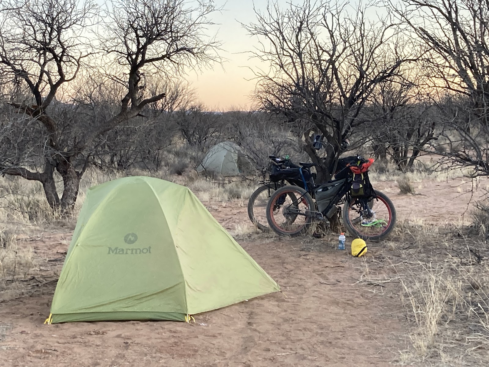
The road that went past the campsite looked as though it only had two or three car tracks on it since the last time it had rained or been graded. We stood in the road watching the jets and talking about the day’s events for some time as the sun set and the bright moon rose, illuminating the vast desert.
That night the wildlife was very active. We had a pack of coyotes very close to us. I had to laugh to myself when I was in my tent, if it’s not cattle it’s coyotes. It was a little unnerving as they were walking around our tents so close to us. They did seem to be very cautious as they came near our site, that is, as far as I could tell from their sounds as they stopped howling when they figured out we were there. As they got further from us they once again called out. The howls, so high pitched and loud. More howls calling back in the distance. Each howl was quite different. There seemed to be about six of them in the pack near us. Tracks in the sand that morning when we packed up confirmed how close they had gotten to us.
As we left our camp our main concern was making it to Amado on the water we had remaining, about 30 miles away. Luckily, just up the road from the camp we did find water on the appropriately named Bueno Tank Road. Just by luck though and this is why. We had spotted a random building in the middle of nowhere. The building was clearly abandoned. We rode in to check it out. The doors were all off of it. The floors inside were laid with neat Spanish tile that is so specific to the desert southwest, now all covered in dust and sand. The walls in an open outdoor area provided a great backdrop for a nice bike picture.

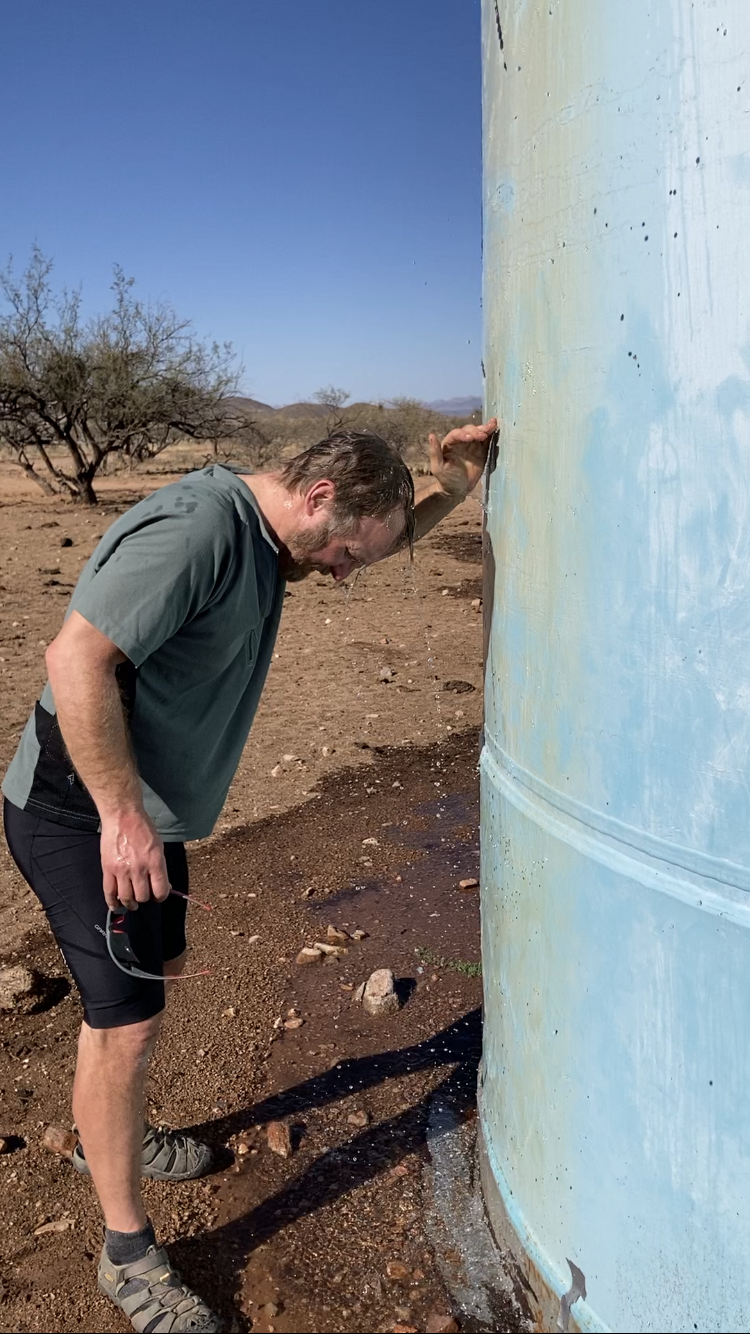
But what we noticed behind the building by accident was a humanitarian water tank.

The tank was powered by solar and protected against vandalism by a razor wire fence. A blue weather torn flag was a beacon for weary immigrants trying to cross this vast desert. The water was amazingly cold and had no aftertaste. It was such a great find. But it wasn’t our only cool water find of the morning.
Continuing eastward exiting the refuge with Boboquivari Peak to our backs

we headed into more unique types of cactus.

Out of the refuge we were now on public open ranch land. Cattle tanks appeared here and there alongside the rocky, sandy two track type of road. We were still a long way from any civilization and car tracks were still very minimal. Out here I doubt a person sees another car for an entire day. The heat was building as this was our warmest day. Later on the temperature would top out in the upper 80s. One of these cattle tanks had a giant 20 foot tall holding tank over a well.

That tank above the well fed all the tanks in the surrounding area. These are not uncommon to see throughout the route. Not sure what powered this one but others are powered by old style windmills. What was special about this tank was that it was leaking from the top which provided us with a nice cool shower for our hot bodies.
It was such a treat. The little things like this make this trip more memorable.
Soon we would reach a new addition that Sarah had made to the route only weeks prior. It was a little eight mile section that ascended a rough two track that was extremely rocky.
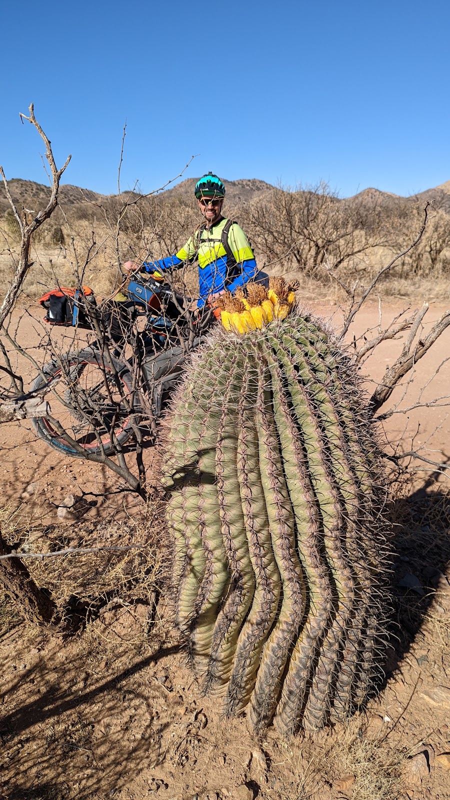
We came across a few giant saguaro cacti, only found in southern Arizona and northern Mexico. What was interesting about seeing these in person was that I never knew that birds made houses in the giant cacti that often live over 150 years.
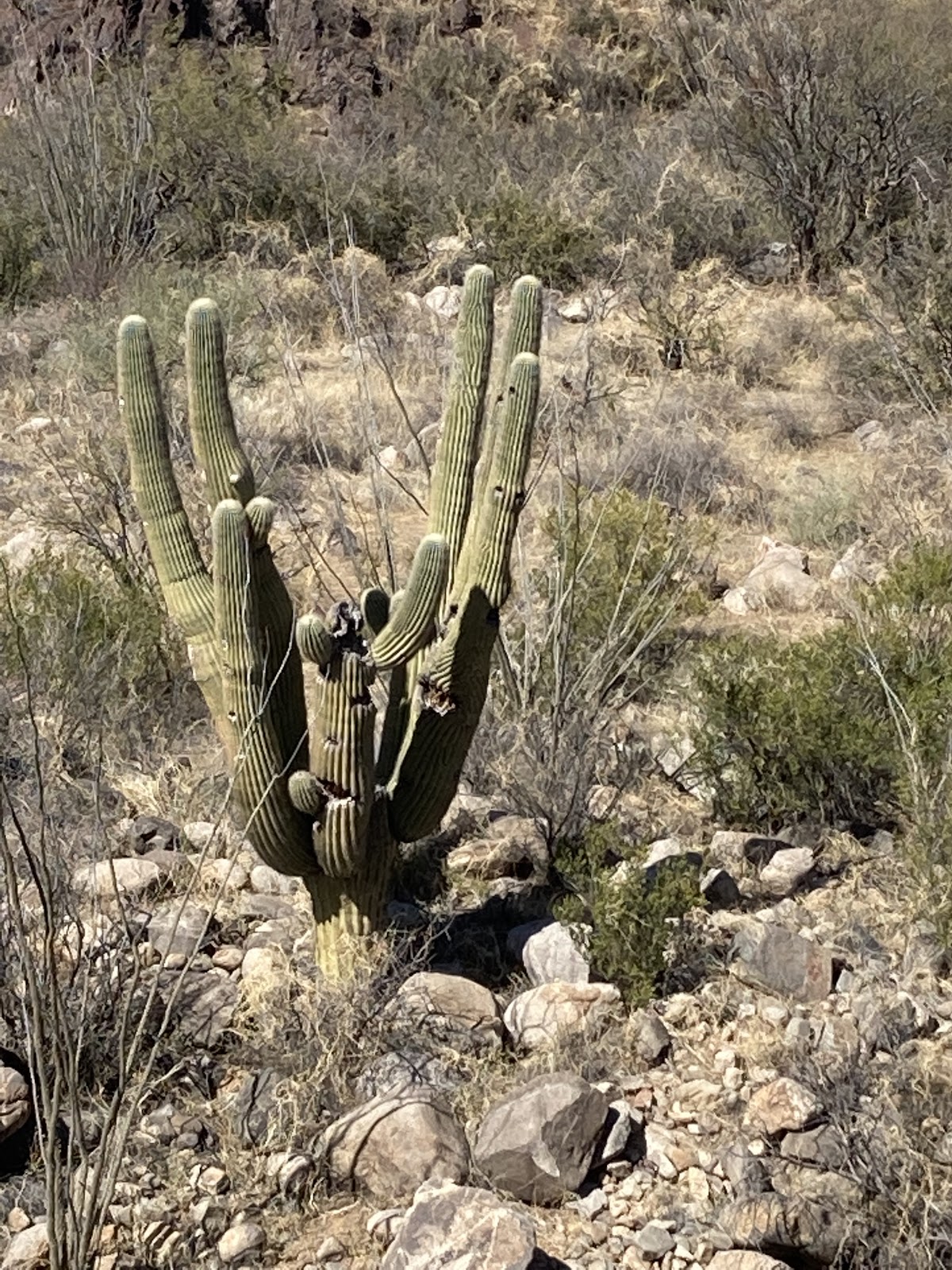
This one seems to be very old judging by the amount of arms it has.
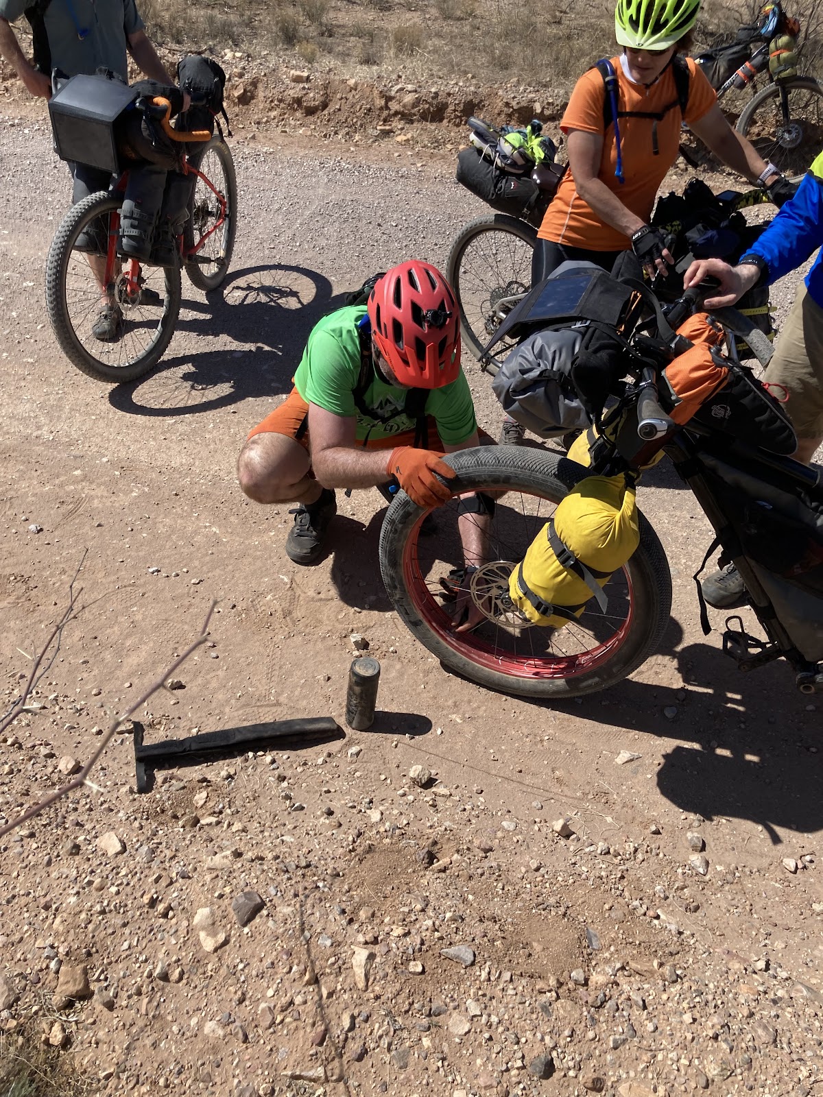
The remaining miles into town took a little longer than expected because of two flat tires on Eric’s bike.
A couple bacon strips and we were on our way though.
In town we had a huge meal at Longhorn Grill

It seems everyone that has done this route has a picture in front of that entrance into the restaurant, so here it is. Being day three of our ride the generous portions and high carb content of the food was just what everyone needed. We needed this to fuel us for the remainder of our day as we had what was definitely the most difficult section of the route in front of us.
The Elephant Head singletrack on its own would be challenging on an unloaded mountain bike. We had bikepacking gear and all but David had rigid frames. We knew we had a daunting task as we climbed and climbed out of town with Elephant Head Mountain staring directly at us as we pedaled a slow, endless grind up. We knew the stats were 3,500 feet in 14 miles. Seeing it in front of us was eye opening.
Blacktop quickly turned to gravel and gravel turned to jeep road, still climbing. Deep down we knew that we’d end up climbing the entire height of it but at the time we were in denial and kept telling each other things like, “oh there’s a trail you can kind of see that doesn’t go to the top, I bet that’s our path”.
So here’s how it all went. Part way up the Jeep trail portion David starts bonking. He needs a break. We stopped for a while and let him recover. Once he’s good we go a little further with the agreement to break often on this climb and take it slow and steady. We stop at a little parking spot on the side and Eric hikes downhill on a trail while Chris and Candy push on. Eric comes back up all excited telling us there’s a mountain stream down there so David and I hike down to check it out. It was glorious as we washed our legs of the days dirt and cooled off.
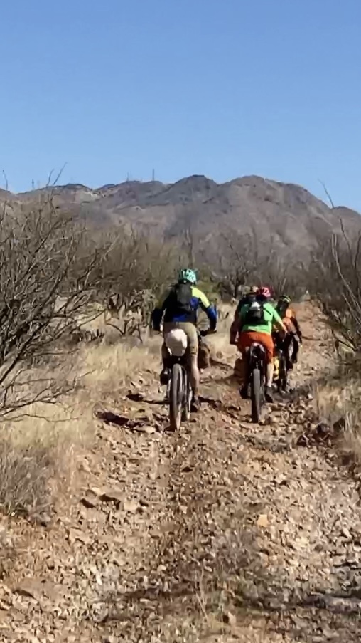
After that great break we caught back up to Chris at the start of the singletrack. He said that Candy was hiking the singletrack so she got a head start. 11 miles of singletrack lay in front of us. We try to ride a little and it’s too steep so we’re walking too.

There were some short downhill sections, one in which I crashed, within all of this but mostly uphill. Within the heart of the rocky mountainous portion of it were some spectacular views.
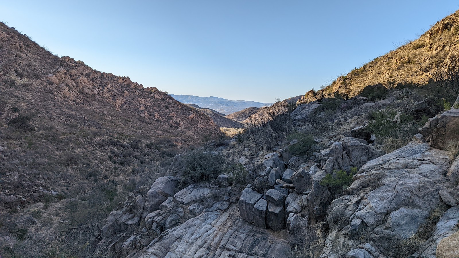
And then there were these cool rocky peaks.

As we came down out of here we ended up getting a little lower into a plateau area of beautiful singletrack weaving in and around thousands of prickly pears. It was something I’ve never experienced before.
After getting through this section we entered more rocky singletrack

with shrubby trees before popping out onto a road that was our final climb to where we would camp. By the end of the singletrack I had a migraine coming on. I realized I left my prescription at the car so I was going to have to push through this. Before it got too bad I did get to take in what was probably the most amazing sunset of the trip.

My migraine got pretty bad at one point when I got off my bike, laid the bike down and put my back up against a tree and just sat with my eyes closed. It was dark by that point. I didn’t think I could push on. Dizziness was setting in along with the head pain. At that spot I think we had 2.5 miles to go to climb through Madera Canyon and to Bog Springs campground. I got up and forced myself to push on. Everyone was pretty worried about me as they have never seen me with a migraine. It was amazingly hard to pedal up those last couple miles. Oh yes, and we were out of water. Eric’s video of us climbing the hill said it all. “A long day 3, climbing a fucking mountain in the dark hoping to find water, it’s been an adventure, a great adventure.” I barely remember that happening but the video of it was a crazy display of how slow we were all going. I also slightly remember Eric asking a lady, who was listening to owls, how much further the campground was and I remember her being really put out about us scaring away the owls. But everything kind of was a blur by that point. I’m not quite sure how I pushed on but I was just on some kind of autopilot and only thinking of turning the cranks and staying upright.
We did make it to the top eventually, but to find that no camp spots were open at Bog Springs campground. Eric found a guy that let us stay in his site since he was just sleeping in his truck. It was such a lucky break. And the campsites all had water.
I set up my tent but the surface was all rock and no way to put a stake in. There was nothing left in me. I grabbed a couple large rocks and used them to hold my tent guidelines down. I got into my tent without eating any dinner and passed out.
The next morning I was feeling pretty good but only had a little lightheaded feeling left. By the time I packed everything up and ate a crap load of food and drank like 40 ounces of water I was feeling ready and excited. I knew we had a giant descent and I also knew Box Canyon was early on today. Super stoked about this day!
So yeah, the descent down Madera Canyon was between four and five miles of smooth asphalt. I never pedaled the entire descent and only hit the brakes once for the one sharp hairpin corner. It was a fun race down to the bottom. Once at the bottom we turned east onto gravel for our approach into Box Canyon. The road twists and turns along the canyon edge on a bench-cut road, so amazing!

Down below in the canyon we saw hikers that looked like small dots. We stopped a few times to take it all in. It is in my top three favorite places on the route.
Once we got through Box Canyon we came into some super smooth gravel making our way through rolling hills for a short distance that were beautiful. It was maybe five miles of this. Winding our way among the Emory Oaks and tall, golden grass through those hills felt so peaceful as the air was a perfect temperature and the morning breeze, so gentle. It was a perfect morning at that moment.

A small private ranch, which are far a few between, sat in the valley of one of those hills in a picture perfect location. Some remaining snow on a distant mountain completed the backdrop.

Once through those hills we came up on a pretty loose and wild section of the route. The roads soon turned to two track and Jeep trails.

Maybe even narrow enough for just ATVs at one point.

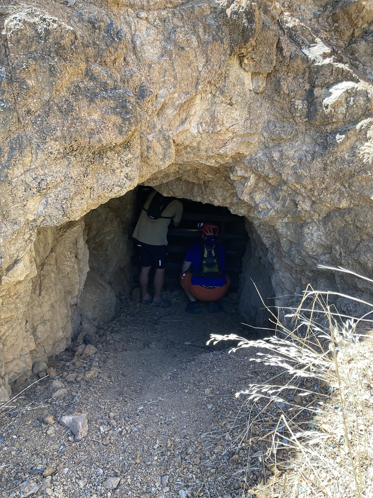
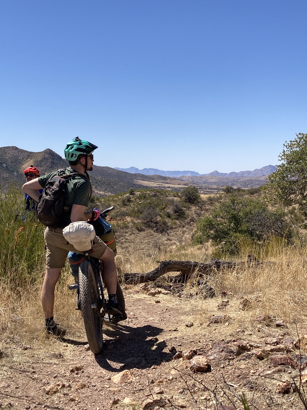
We did make our way up and down in elevation quite often in that section, giving us super amazing views,
and at one point, even finding a cave.
As we got further along and closer to our town of the day, Sonoita, we started seeing a few people. Two people sitting off in the grass, assuming they were hikers, yelled “get on it” as Chris and I were racing each other through the rough stuff. Chris likes a little competition once in a while.

Until he gets on it a little too hard.
A long descent once again down into town (all the towns seem to be in valleys so we looked forward to that, maybe even more than the food) and we stopped to eat at Copper Brothel Brewery. Service was slow as I’m sure they are dealing with the same labor shortage as the rest of the world but the food was delicious.

With full bellies we hightailed it to our camp at Appleton-Whittell Research Ranch, a gated private area that you have to gain access prior to going. We also had reservations to stay there. Because of Covid we were the only group allowed in for the night.
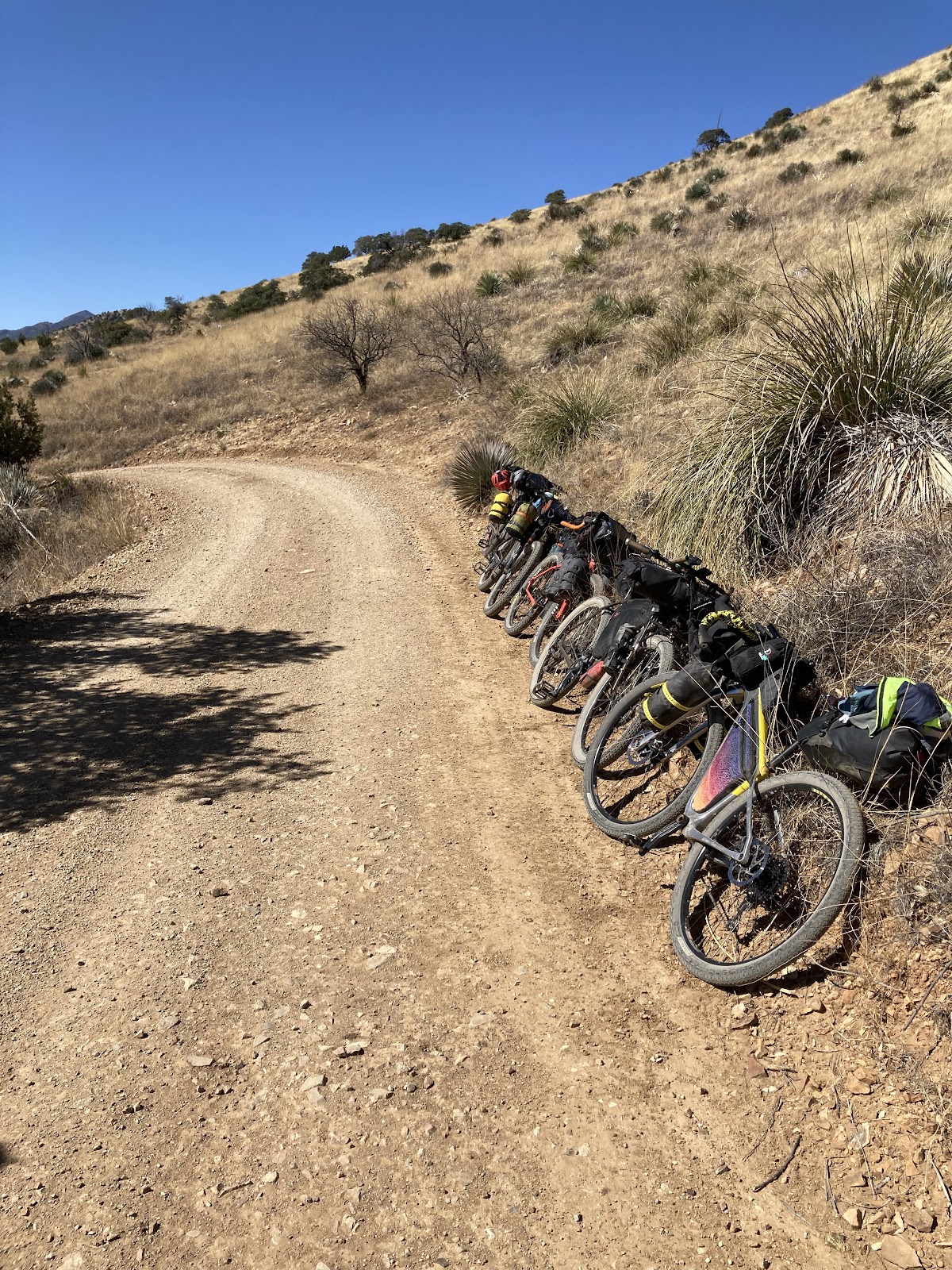
For the ranch we had emailed instructions on exactly where to go. There were a couple dirt roads and paths through the enormous stretch of land. The spot where we would set up our tents had a casita that was for our use. I went in the casita and called the main office to check in with Cristina, the ranch manager. She was excited to hear that we had made it and told me she was going to come down to say hi. A few minutes later she came rolling in on a e-mountain bike. The first thing she saw was that we used the cool bike rack that Sarah Swallow and her team built and said Sarah would be super excited that we were using it.

She also pointed us on the direction that we would go when we would leave in the morning as well as telling us about the land at the research area, the different species of birds and animals in the area and about all the adversity that the monsoons of the late summer months brings.
The casita was a really neat building.

It was insulated with straw and had an interesting heating system consisting of black wall, air gap, and glass on one side. The inside had a bathroom, kitchen, and seating area. The exterior had a really neat outdoor shower.

That night was super cold once again. I abandoned the tent and headed to the casita at 4:00, my 55 degree sleeping bag not cutting it. Chris was not long after me.
After a nice warm night I was well rested to make our final push for the end. The ride through the ranch was very beautiful and very open.

After exiting the ranch we had a few gravel roads and some nice hills to climb returning to a more mountainous area with higher elevation and more trees. This was the last change in the landscape before bringing us to the great Arizona Trail. The AZT would be 14 miles of singletrack and close to the last remaining distance of our ride.
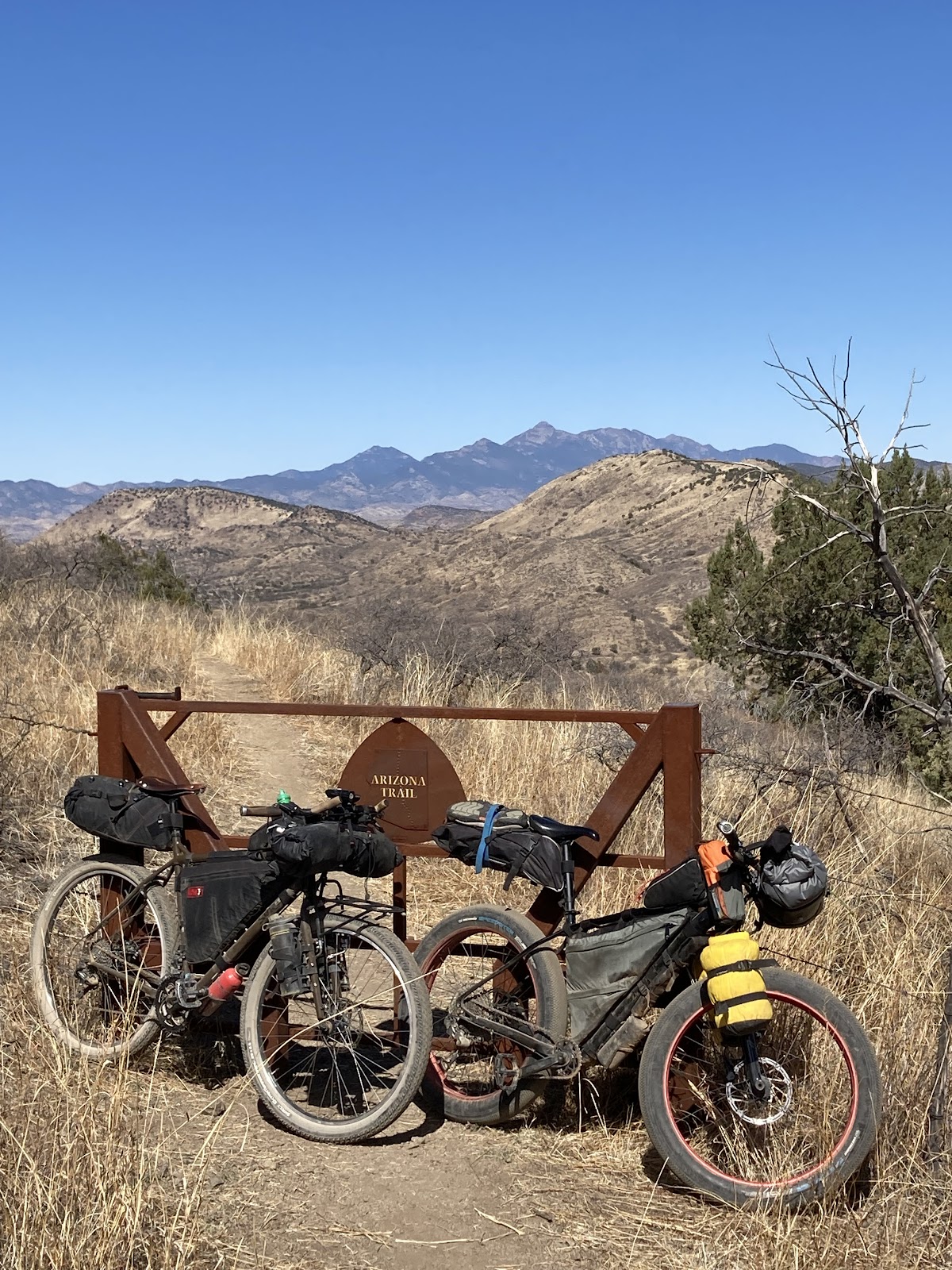
This section of the AZT, 14 miles out of the total 800 mile system, was nothing short of spectacular. I would love to come back to just ride this unloaded. Taking it on with fully loaded bikepacking rigs was a huge accomplishment. This section started with a long climb with switchbacks up a mountain. We continued on through areas with spectacular views as the trail twisted and turned gaining and losing elevation throughout. It took us four hours to do this 14 mile section stopping many times but also going quite slow.
The last descent of the AZT that led us back down to Patagonia was super steep, loose rocks with switchbacks.

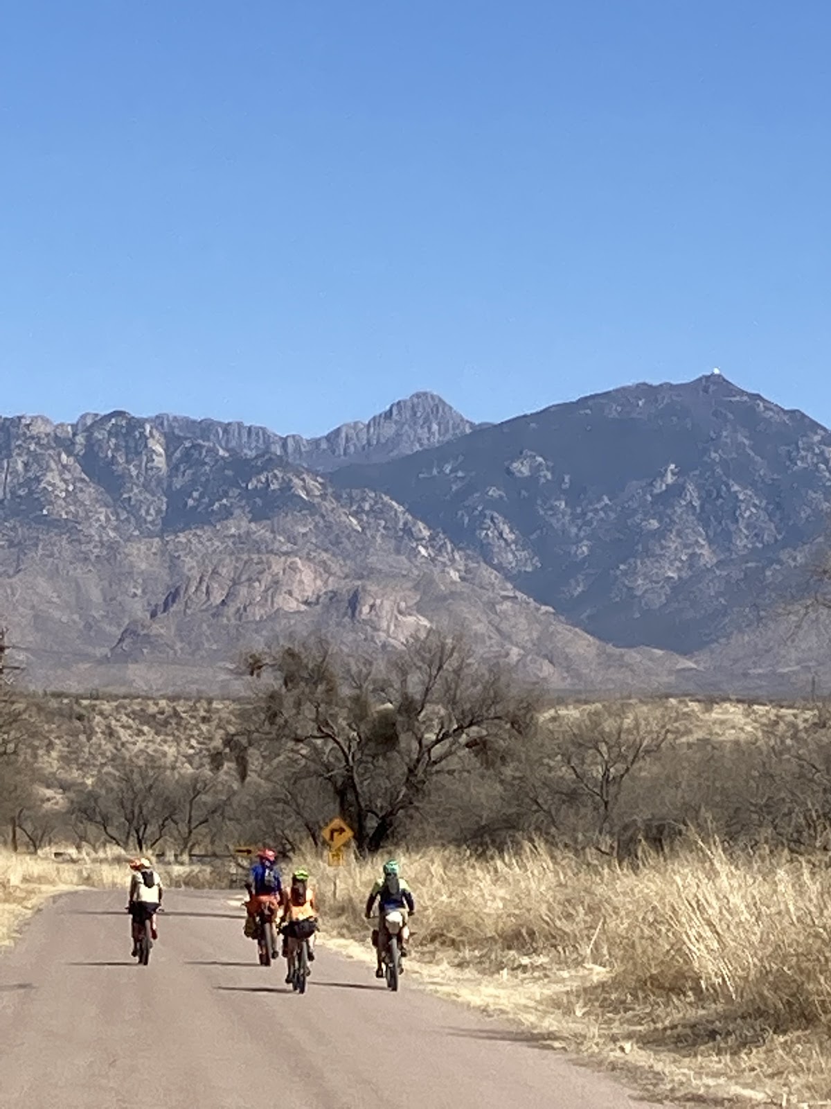
A fast spin on the asphalt and we were back in Patagonia where the only thing left to do was order a late lunch at a local restaurant and take in what we all just accomplished.
This was an amazing trip and the biggest adventure that I’ve taken so far. I had some of my greatest friends to share these memories with. Really strong riders, knowledgeable on all aspects of bikepacking and what it all entails, and exceptional human beings that I am lucky to know. After riding in this area I have so many more adventures on my list that will be sure to happen and I think it goes without saying that those four would be right there with me.


Read this while spending time in the Mohave Desert so some of the things you described were familiar. Love bikepacking but have never done it in the desert. Actually just did my first off road desert ride last week. Thanks for posting and feeding the adventure seeking wanderlust in all of us!
LikeLike