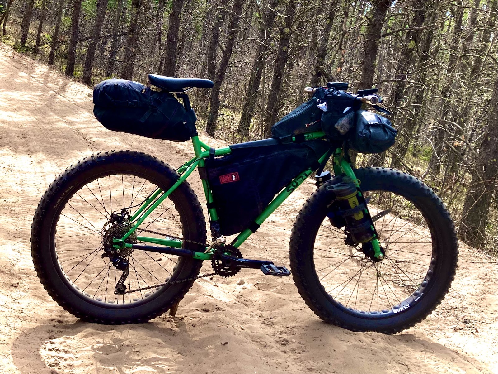
The idea of this route was a long time in the making. A couple years ago I discovered he sand roads around Butler Rock and I was recently thinking about those roads with the intention of creating a fatbike specific bikepacking route. The thought of creating a bikepacking route through areas too difficult for tires narrower than 2.8” was really intriguing to me. I’ve been to the Butler Rock area many times since that initial time there. In fact it’s the area that I used for the 2021 Tour de Nicolet route. But the roads I used on the TdN, although sandy, are some of the easier in that area to ride through. I wanted to dive deeper into the area, making this more of a challenge and find all that the area had to offer. On April 16 of this year I made my first scouting trip with the goal of discovering as many roads as possible that are rarely used. I used the fat bike for that ride and laid down tracks on over 85 miles in the area. Some of it was still ice covered. I came away with a good understanding of what I wanted the bikepacking route to look like.
When I got home I mapped my bikepacking course based on what I had found in April as well as past knowledge of the area. One of my other objectives was to map the route through the Nicolet Roche but to use only the two track instead of the singletrack trail but still stay really super close to the singletrack, at times crossing paths with it. I would follow the general direction of the singletrack from south to north. The reason for this was to create a route that could be ridden even when the singletrack was closed for the season or to give the rider the choice of riding the two track or singletrack or a mix of both. Or a person could decide to make the Roche their camp location and ride singletrack for the day, making this a three day adventure.
For my trip I decided that my best point to start at would be in Lakewood. There are numerous places to start, which I labeled on the map. Where I chose has a super nice paved ATV parking lot with bathrooms and it’s right in town. A bike rack is placed near the bathrooms, which makes me feel that the town welcomes and promotes cyclists. It would be a safe place to leave my vehicle overnight. The bathrooms would provide a great place to change out of my bikepacking clothes after the ride. There are also a few restaurants in town for after the ride.
Three weeks later on a Monday morning I set out on my overnight trip. I had a few camp spots in mind so I was pretty chill on my pace and let the day come as it may. A mile or so of atv trail connected me to some super curvy and hilly blacktop. A person starting this route might be initially thinking that this will be super easy and quick. A roadie came at me, zipping along. Probably a great road for local cyclists with its curves and hills skirting along the edge of Paya Lake, the lakeside cottages empty for the week. A couple short bits of gravel until mile 10 and then I hit endless gravel. At mile 14 I got off of the main gravel road and onto four miles of atv trail that brings me into Crooked Lake. Being a Monday nothing was open in Crooked Lake so I just passed through and back onto some atv trail. The groomer was out smoothing out the sand making it extra difficult even with the fat bike tires.
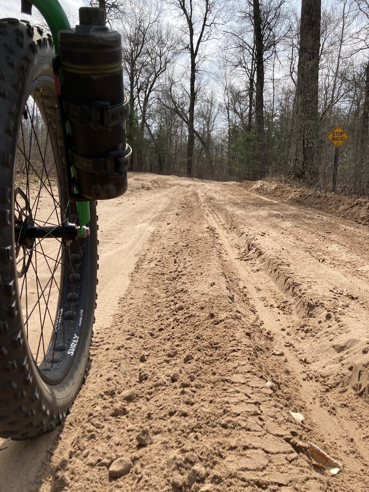
About four miles of this super loose sand and then the surface started consisting of more of a gravel base making things a lot easier to roll on.

I found a super cool two track that atv’s were not allowed on which connected to another road and as a bonus I avoid going down County Road W. Great find!
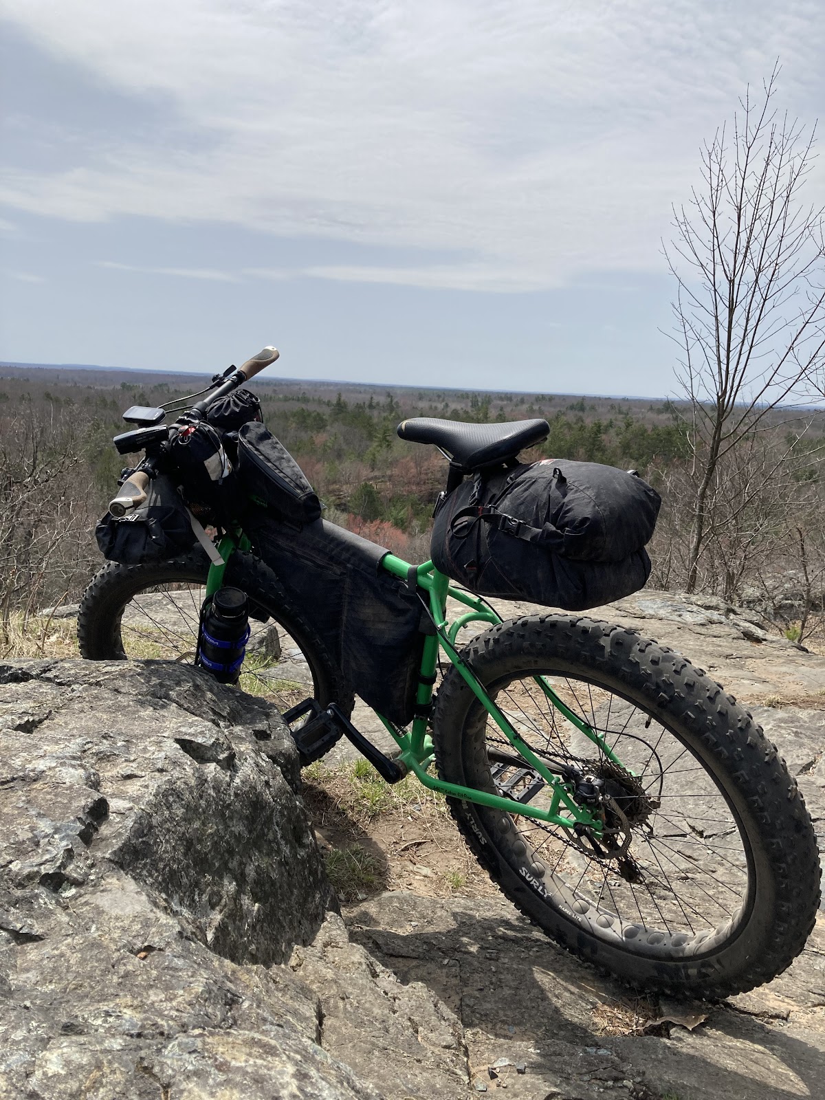
Some more miles of super loose sand and sections of gravel in between to break things up before coming to Butler Rock and it’s super high view point if you decide to hike up. I don’t always take the hike up but today I did and I sat and ate lunch at the top.
The day was windy with gusts in the 40’s predicted. It was at least that gusty, maybe higher.
Continuing on was more of the same loose sand before coming to a firm gravel road for a few miles. I spot a snowmobile trail that has a sign posted for no atv’s.
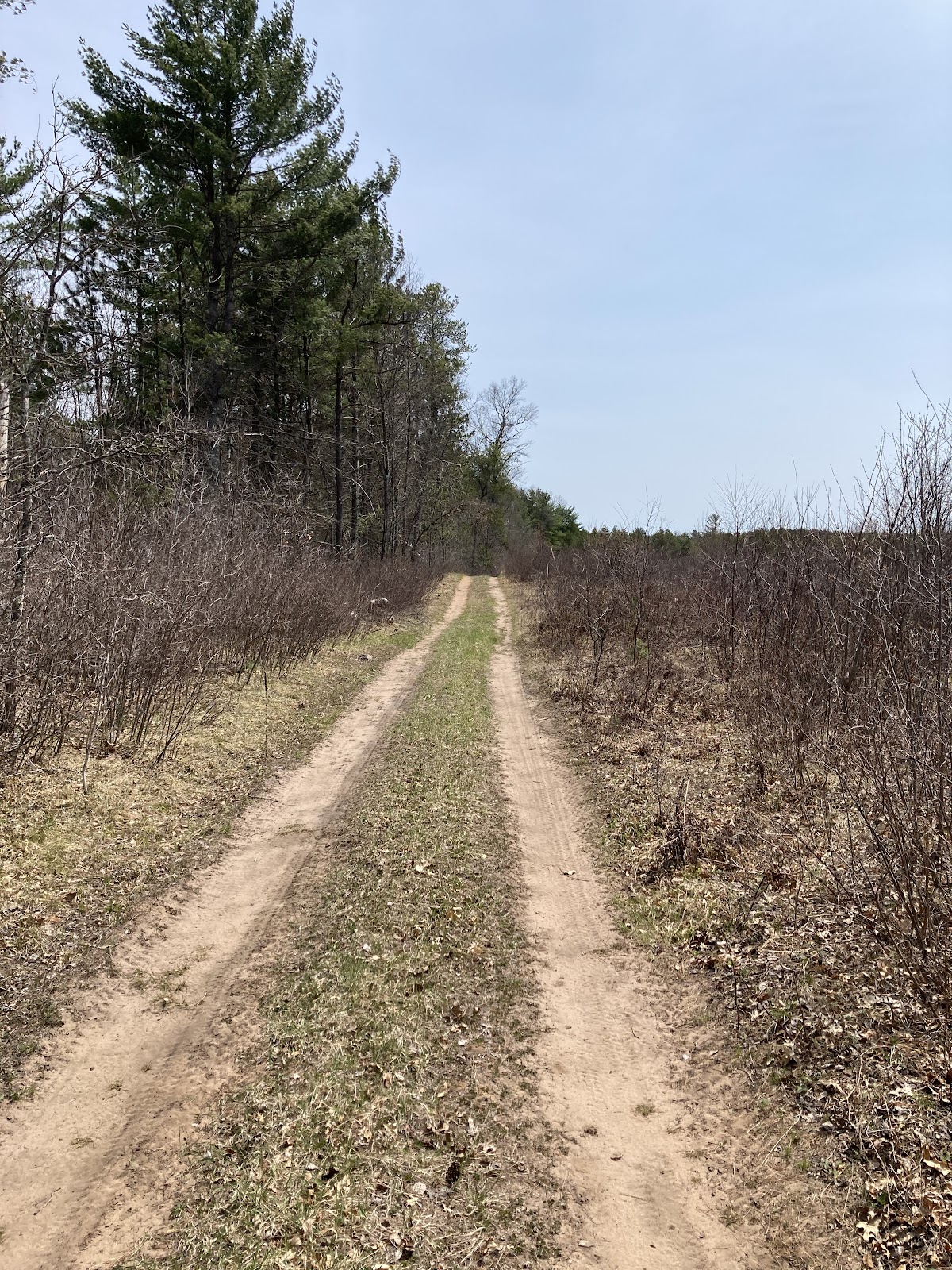
I take it hoping to find a nice path through and be off the beaten path a little. A distance in and the trail forked. I take the more overgrown direction and soon the truck tracks that kept the grass at bay made a loop to turn around but I kept going, regardless. It starts to get more overgrown as I hike my bike around fallen trees and soon I am carrying my bike over downed trees before coming to a total trail blockage of downed trees, impossible to get my bike through. I turn back to the last split and ride that out to the main road. Making it out to the main road I still consider this a win cause I did use about three miles of snowmobile trail and avoided that much of the main gravel road. I also came across a sign posted that I was alongside Waupee Lake Swamp State Natural Area. This happened to be a nice find with its views of the small lake off to my left and one that I would not have found if I stayed on the main gravel road.
Continuing on the gravel I made my way to the most southern portion of the route. After one small river ford
I came to an area that was recently burned from a forest fire only to discover a half mile later that I was riding into that fire. The winds were so strong that it pushed it across one gravel road. My route went around the back side of it and as I rode in the direction it was pushing towards a police car came in with its emergency lights going and soon after the forest service fire department came with sirens on.
I went around the front side of it safely as the main fire was still a ways from my route. It was a good reminder of the consequences even a small campfire could have.
I reached the blacktop that brought me towards Mountain and Bagely Rapids National Forest campground. With the wind at my back I made quick time on the five miles of asphalt. Rolling into the campground I had my pick of sites with only four other sites taken. With the forecast for possible severe storms I picked one with the safest looking trees. I also was lucky to have a site on the river.
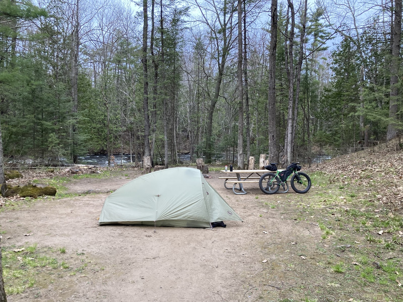
A quick meal of Mountain House was what my belly needed after a hard day in the saddle. After dinner I got rid of my trash from the day and from dinner and then refilled all of my water before going to bed for the night. I had the roar of the river as background noise however it was a restless night with the possibility of storms weighing in the back of my mind.
I woke up early the following morning with only a sprinkle throughout the night. Any lost sleep was for nothing. I got everything packed up, ate a meal bar and an apple for breakfast and made my way onward. My first five or so miles were made up of atv trail on the old railroad grade, the surface being super loose but not bad at all on a fat bike.

Two nice bridges overlooking the river was the highlight of the five mile stretch. Also, in the middle of that five mile stretch was the town of Mountain consisting of a restaurant and two bars and a gas station. On a Tuesday morning the only thing open was the gas station. Turns out they had a great selection of ready to eat hot breakfast sandwiches. Thinking about the unseasonable heat and humidity I would be facing that day, I also grabbed a bottle of Body Armour.
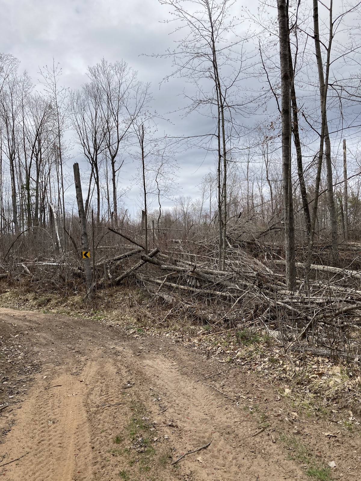
After the grade I crossed highway 32 and onto a logging road with active logging going on. Passing two log truck semi’s bouncing along down the rough logging road I thought about the enormity of the amount of timber that was hauled out of the area from the 2019 blow down, a super powerful straight lined wind storm that took out trees in a line from Jack Lake to Mountain. For anybody not familiar with the area, as the crow flies it is roughly 30 miles in distance. I was heading into the blowdown area and would be in the hardest hit part of it later in the ride.
After crossing highway 64 I came across another snowmobile trail that I decided to check out. This one worked out to actually take a short cut to where I needed to go and it was a more exciting way to get there not only because it was off of the main gravel road but also had some nice down hills and ended with a run through a tall stand of red pines. Once back on the gravel it was not long until I made a left onto another atv trail. This one was another that had soft beach sand. Lots of turns and punchy climbs meant hike a bike in a few spots. Midway through this short two mile section I came across a giant bullnose snake laying on the trail.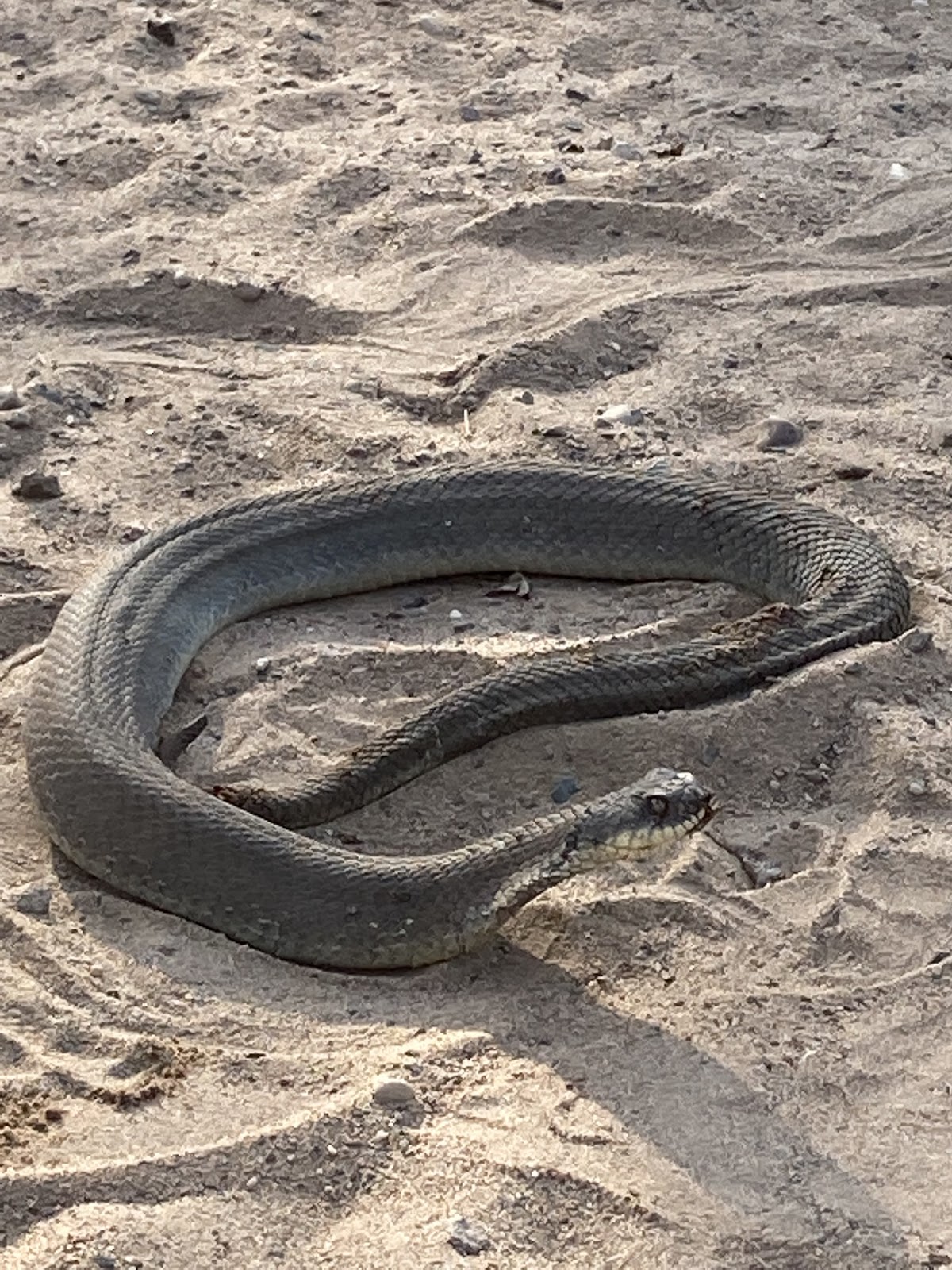
I picked it up with a long stick, its head flattening and getting wide as I did, to get it off of the trial where it would be safer. I was glad I took this road and came through at the time I did cause I got to see such a cool and unique snake.

After the atv section was another nice, easy pedal down a couple miles of blacktop and a right turn onto Old Grave Road, a beat up logging road which turns into two track leading to Nicolet Roche. Being here many, many times I knew exactly what to expect, which was a mix of sand roads and washed out roads littered with baby head rocks to super smooth forest two track. After crossing the bridge on Van Alstine road I headed north on two track that I have never been on. Very unexpectedly I had a white wolf trot across the road about 20 yards in front of me. It was the highlight of the entire trip! Of course things happened so fast I could not get a picture but it is something I will remember forever, much like the moose that jumped out of the ditch right in front of Candace on one of our waterfall bikepacking trips in the Upson area. Just a very cool memory to hold onto.
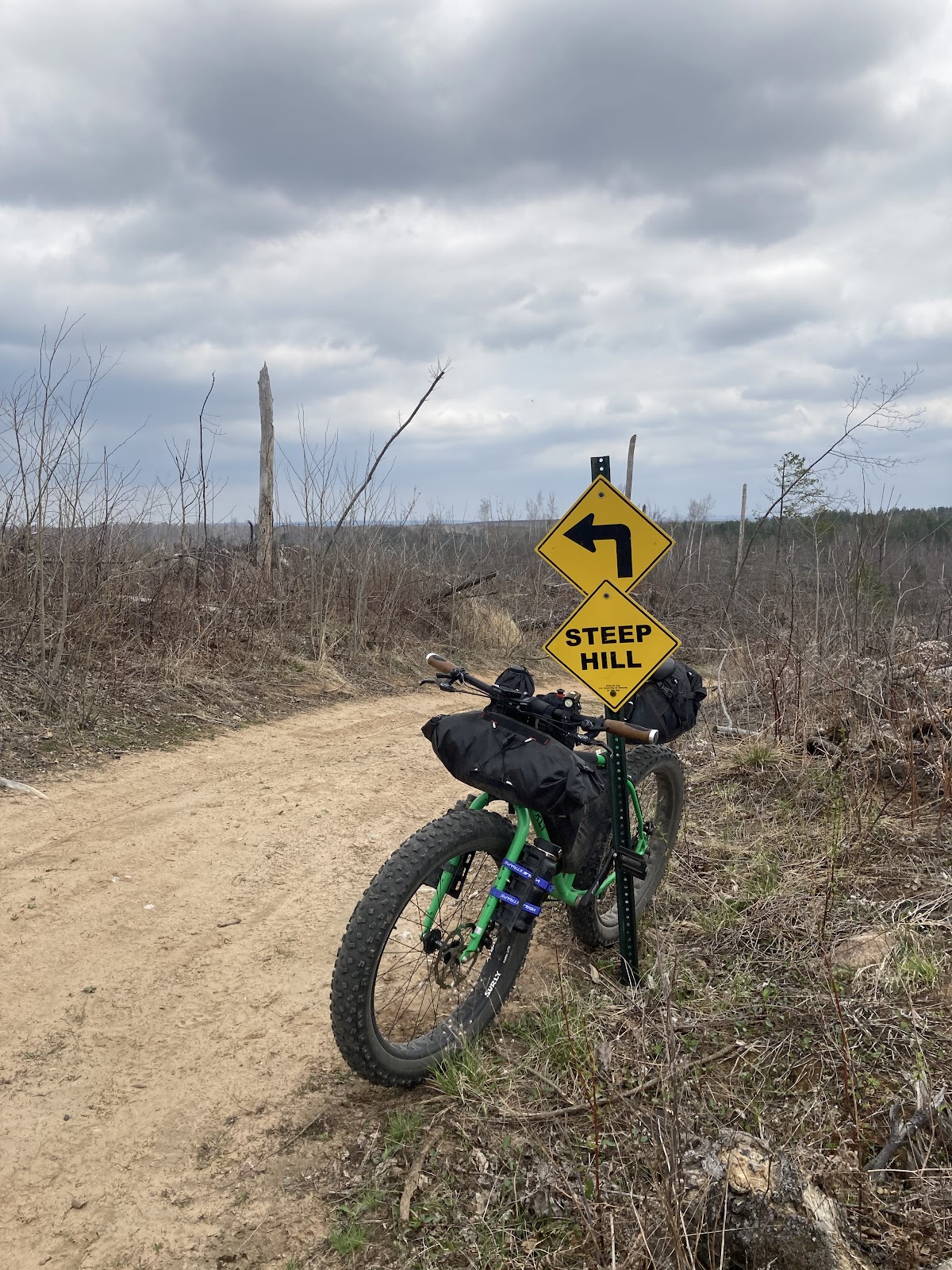
Heading north across highway 64 I climbed the super steep Humble Hill, known from the old Humble 44 Nicolet Roche race.

When you climb (push a loaded bike) up this hill with all the baby head rocks scattered all over it, you think that you are at the top but then it flattens for a second and steep again until finally you crest it.
The downhill after is so fun though. It is void of the baby heads and is super smooth as compared to the climb, yet you still expect some bad spots judging from the road surface of the climb. My descent was great though. A few more climbs highlight this section of rough forest road, each summit featuring a great view of the endless miles of straight line wind carnage, the open landscape now exposing all the hills and valleys.
Another section of snowmobile trail and then onto primarily blacktopped surfaces to finish out the ride. The exception is the unique ride through Cathedral Pines State Natural Area. The gravel road narrows here to one lane through a tunnel of dense trees and moss lined ridges which make up the edge of the road. It is such a fitting way to end the ride and roll back into civilization.

