We rolled into Las Cruces plaza on the long downhill from New Mexico State University a little early, around 8:15 on Saturday morning for a 9:00 start and bikepackers were already starting to gather. Some had burritos that they purchased at the farmers market on the plaza and others were chewing on the danger-bread baguette Pablo gave each of us the day before. Plenty of familiar faces and new friends were there. People who we met on Thursday and Friday on the group ride, the Makers Market and at the Bikepacking Summit. I quickly realized that this is a close knit community. I don’t just mean the community of Las Cruces (although it definitely is) but the bikepacking community as a whole. Bikepackers have a friendly, very laid back nature that makes approaching each other feel like meeting old friends. I talked to some as I made my way around the plaza checking out everyone’s bike set up.
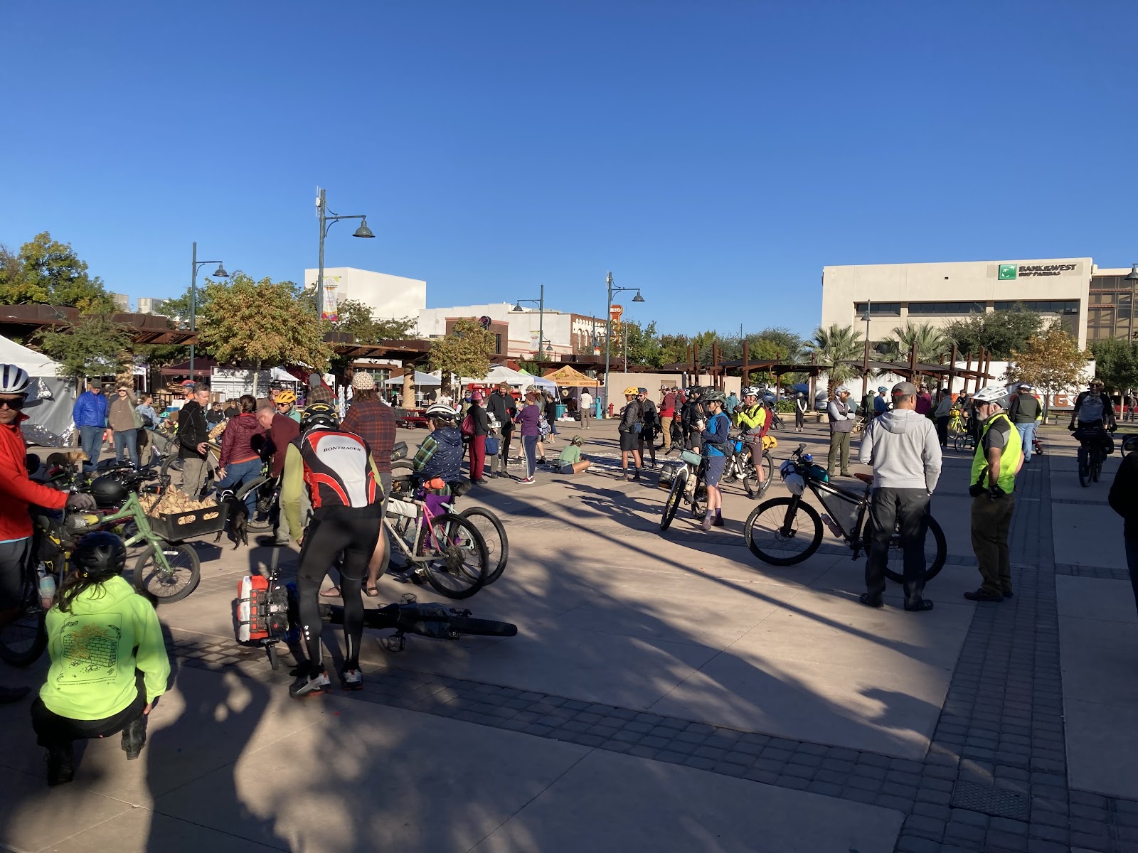
After Matt Mason took the stage to give us a few last minute words we had a slow roll out with Grace leading the way. Grace is on an adaptive bike. She leads the group out of town each year and is an amazing inspiration.
There were about 150 of us on that massive rollout. A lot of passerby motorists gave bewildered stares. A bunch of bikes loaded with camping gear rolling through town.

The Monumental Loop was created in a figure eight pattern with the intersecting paths in Las Cruces. So you had a southern and northern loop, basically. The group soon split in half into two groups, each of us given direction weeks ago on which loop we would do first. Candace and I have the Northern loop first so we go left.
Leaving town on the north loop is a 12 mile process consisting of a few roads, some asphalt bike paths and a little ditch riding. Oh, and ditch riding refers to riding the high mounds alongside the arroyos. Learned that from the Gravalexrs group ride on Thursday evening.
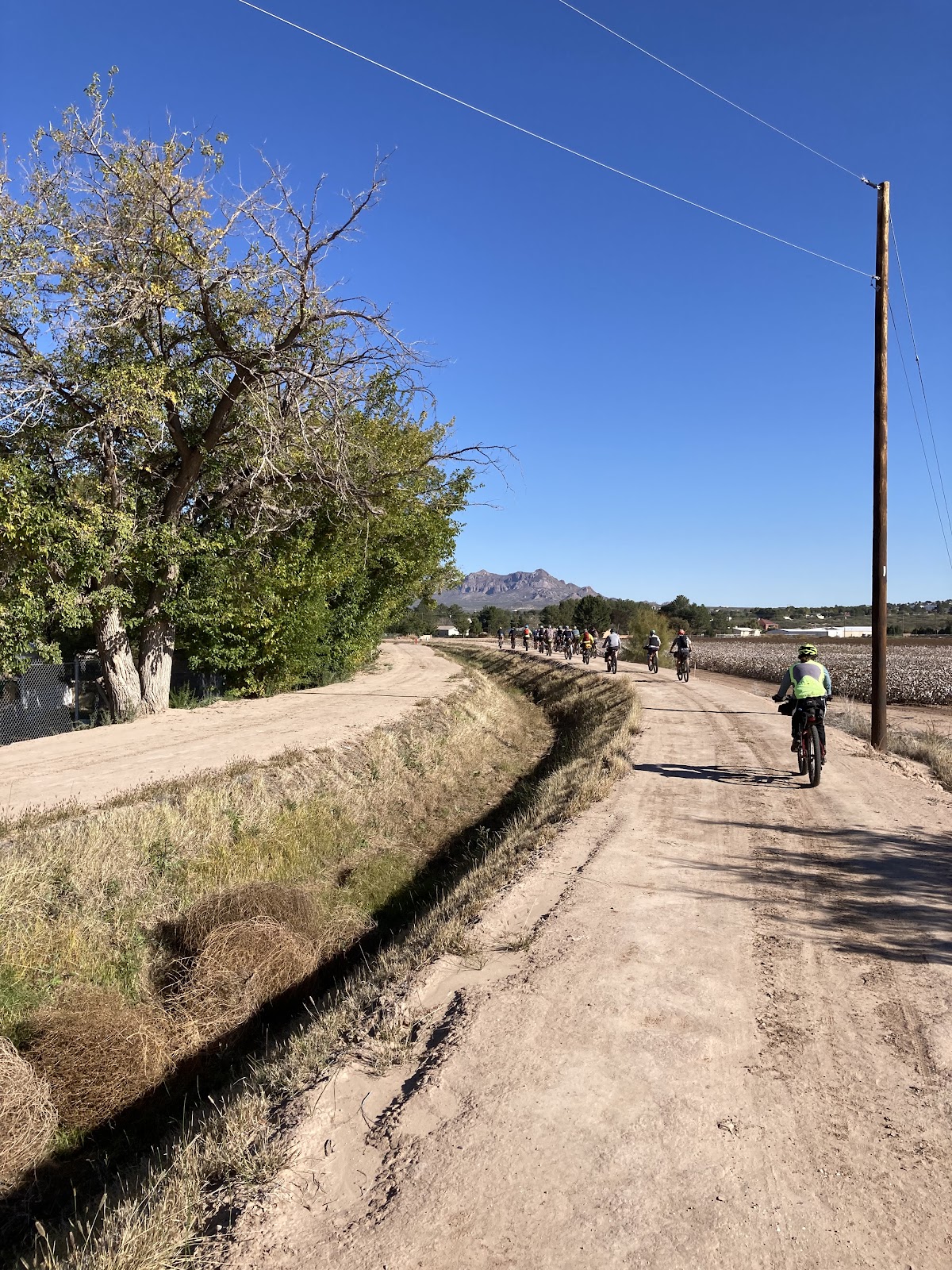
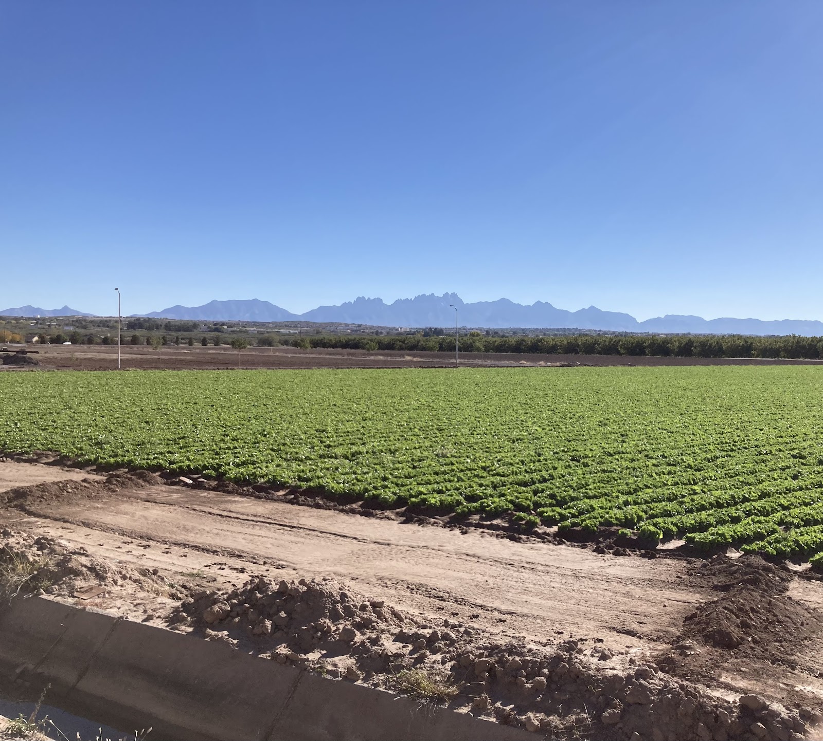
Las Cruces is in a large, flat valley so once you reach the edge of town you start climbing, leaving the cotton farms, alfalfa fields and pecan groves behind.
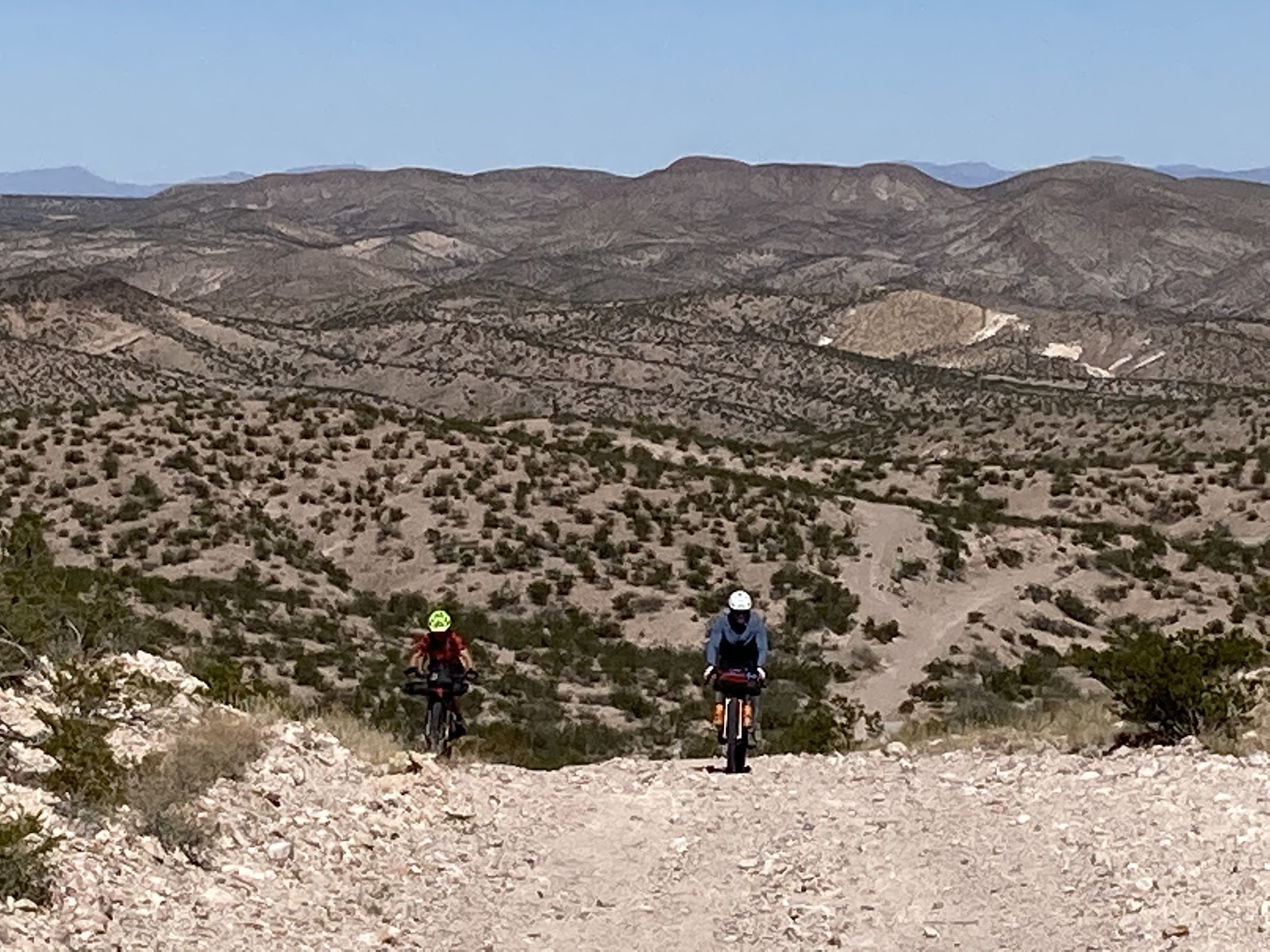
Once we get a good distance from town we turn off of the road and onto the first set of singletrack, the Doña Ana Trail System. The desert singletrack was smooth with very little trail features but with some natural flow. We seemed to be at the high point when entering the trail system so in front of us was a lot of downhill. We had not gone very far on the route at this point so groups of bikepackers were still in clusters in this region. It was fun watching groups of six or eight bob up and down throughout the open desert landscape. Dropping out of the singletrack we came to a long stretch of straight gravel and then onto some blacktop, providing us with opportunities to socialize with each other and meet new friends.
Riding forward on the asphalt we came to a food truck and decided to stop for food there instead of the Blue Moon bar as we heard that the bar was more of a Harley bar or something like that. The food truck served me some amazing Jamaican jerk tacos. Just the right treat before climbing the Jeep trail out of the small town.

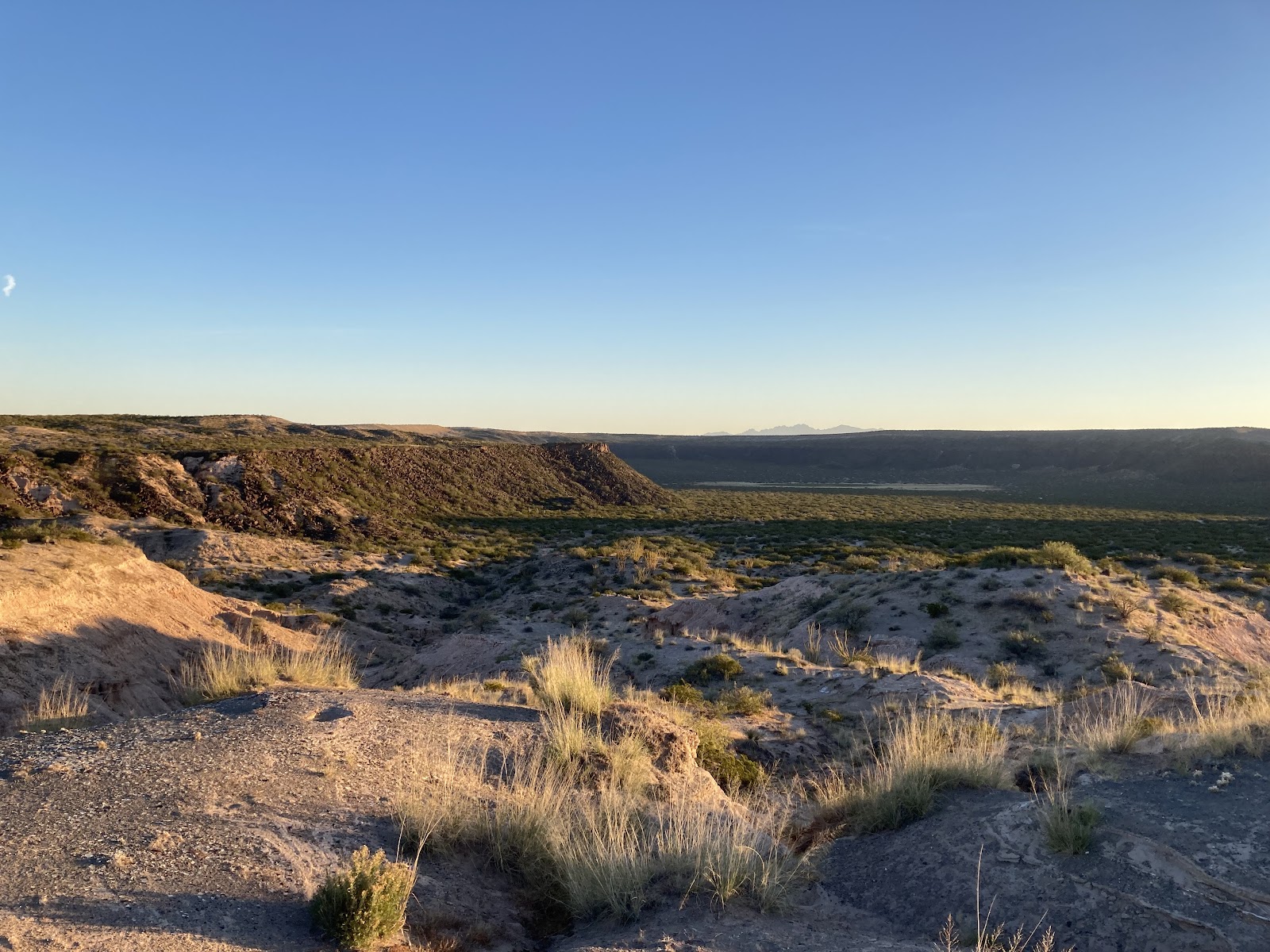
The climb up the Jeep trail was rocky and washed out. Maybe a 500’ climb but once we got to the top we had an amazing view of the valley.
There was another sort of long climb although it’s a bit smoother. As I remember a nice little canyon with plant life and trees was somewhere in there.
Shortly after reaching the summit we also reached the last opportunity to set up camp on public land, which was about mile 54, until after Hatch. Going further meant we’d need to put in another 25-30 miles to reach legit camping areas. It was way too early to think about stopping so the choice was pretty easy to keep rolling.
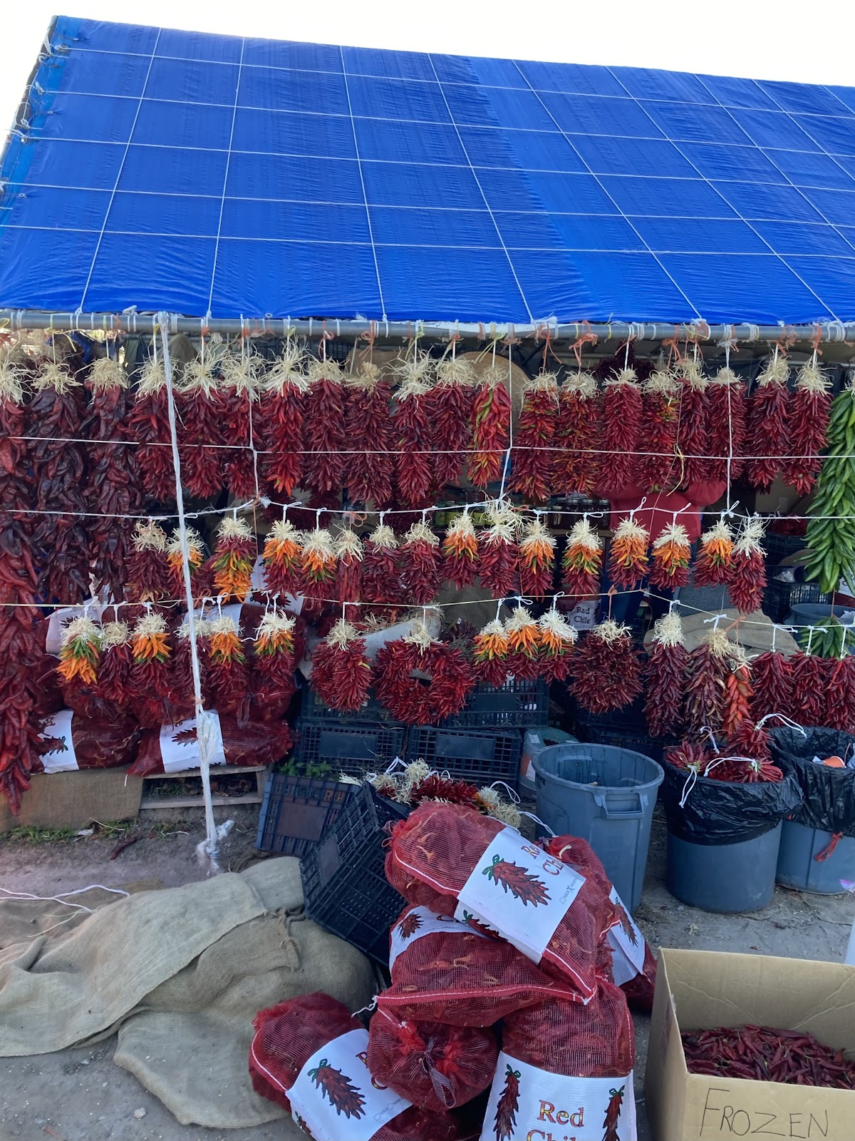
The steady downhill on mostly gravel roads was quite easy and scenic as we entered more farmland. On one of the farm fields we saw a large bird, maybe a crow, take flight with a five foot snake in its talons. As we rolled into Hatch it was clear why the town was the chile capital of the world. Roadside stands were all over the place selling chiles. Gunny Sacks of chiles and dried chiles hanging. Throughout the ride we’d see random chiles laying on the side of the road, probably falling out of farmers trucks as they drove them to the market.
Once in Hatch I was told about Sparkey’s having good burgers. We stopped there where I stood in line outside to order a burger.
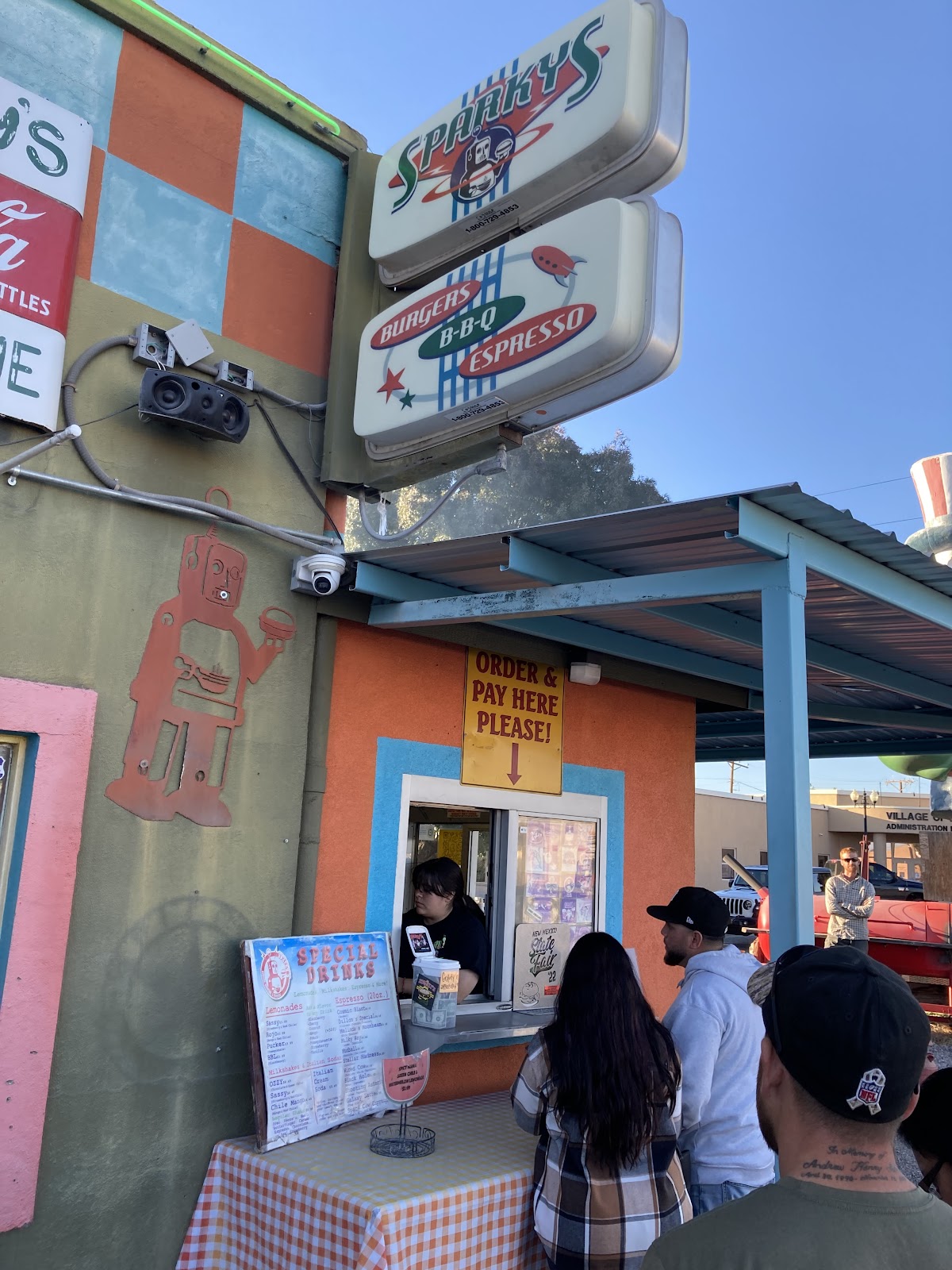
Turns out we got there just in time as they were closing. A few other bikers were not as lucky and rolled through as we are eating with the restaurant now closed. Across the street was some interesting statues, most interesting being the alien.

Sparkey’s is also where we came across Henry, who was a sort-of local from northern New Mexico. It was the second time that day that we saw him, the first being on the singletrack. He told us that there was only one person ahead of us. I asked him if he wanted to ride along with us and he agreed. After filling up our belly’s and somewhere in between the span of the five or so miles of highway pavement and the gravel turn off we also came across Dave, a local fast single speeder. We joined up with him and rode the gravel turn off into the night. The gravel road quickly turned to baby head two-track. The night time riding made it difficult to find a good camp spot so it took us a little while to find a spot big enough and void of too much vegetation to fit our group of four.

A couple times we wavered on a few spots but eventually found a really nice one. After setting up camp we chatted, getting to know each other as we star gazed. The Milky Way was bright. The air was silent. Soon we saw bike headlights bouncing along on the two-track we just got done riding. It took them a little while to reach us. Once they reached us they decided to join us as we had plenty of room. Emily and Erick, both from California. They would end up leapfrogging with us for the next few days and were really pleasant to talk to during our time in New Mexico.
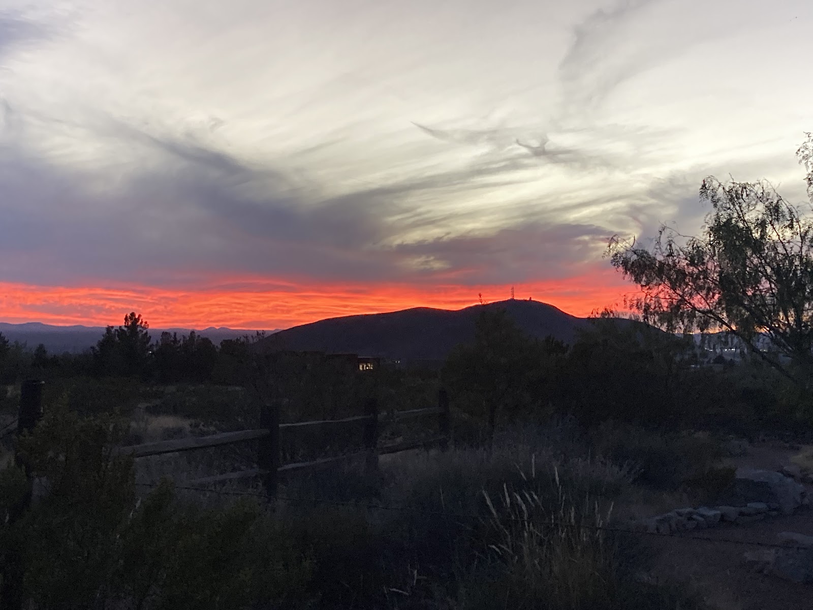
Morning brought a long couple of chilly hours in the shadow of the mountains around us. The view as I opened the tent was amazing though.
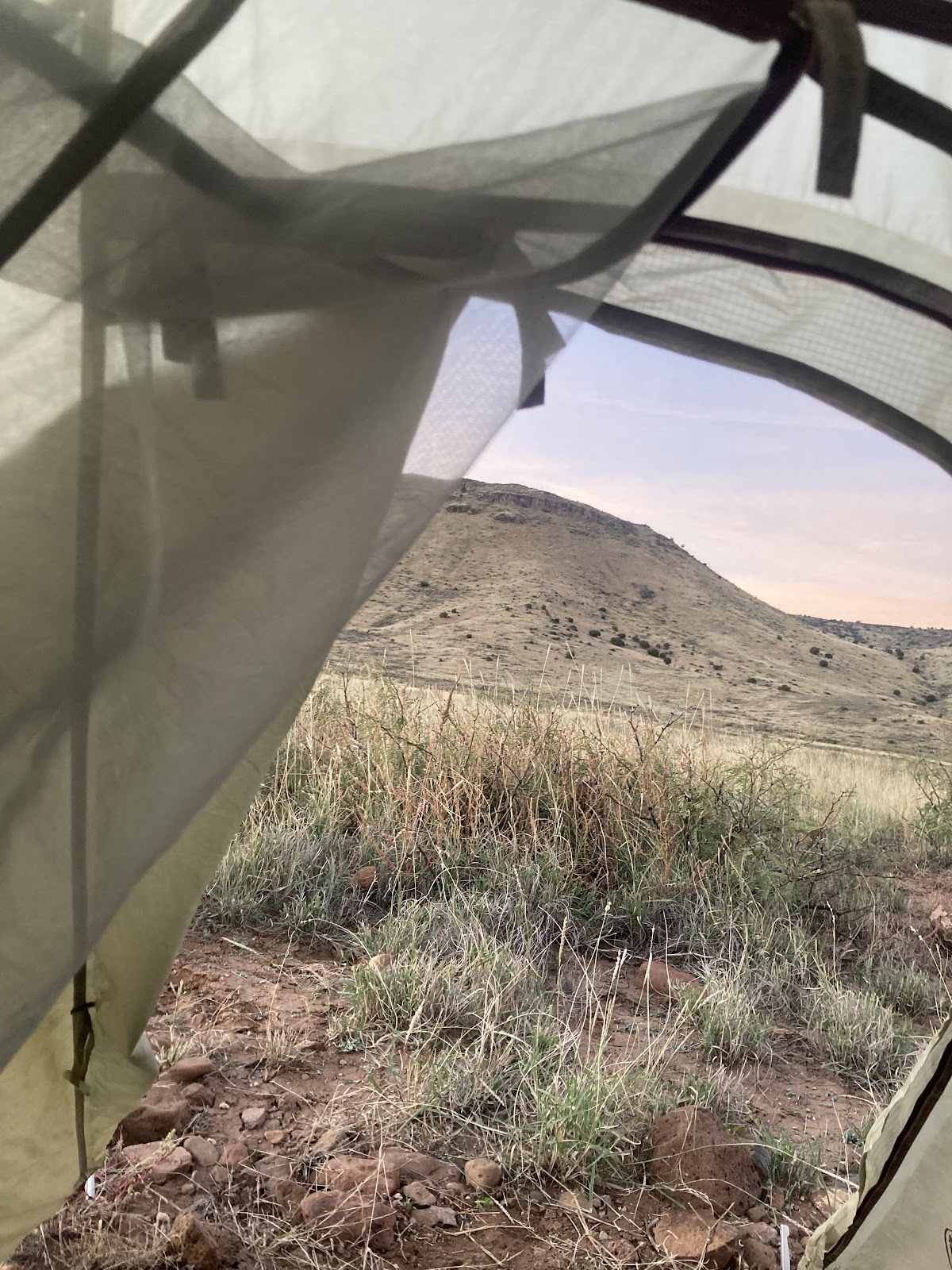
When you set up in the dark it’s always a mystery of what the environment must look like in the morning light. To me that’s some of the magic of bikepacking. As others packed up I made my way up the path to check out the abandoned cabin Dave was telling us about.
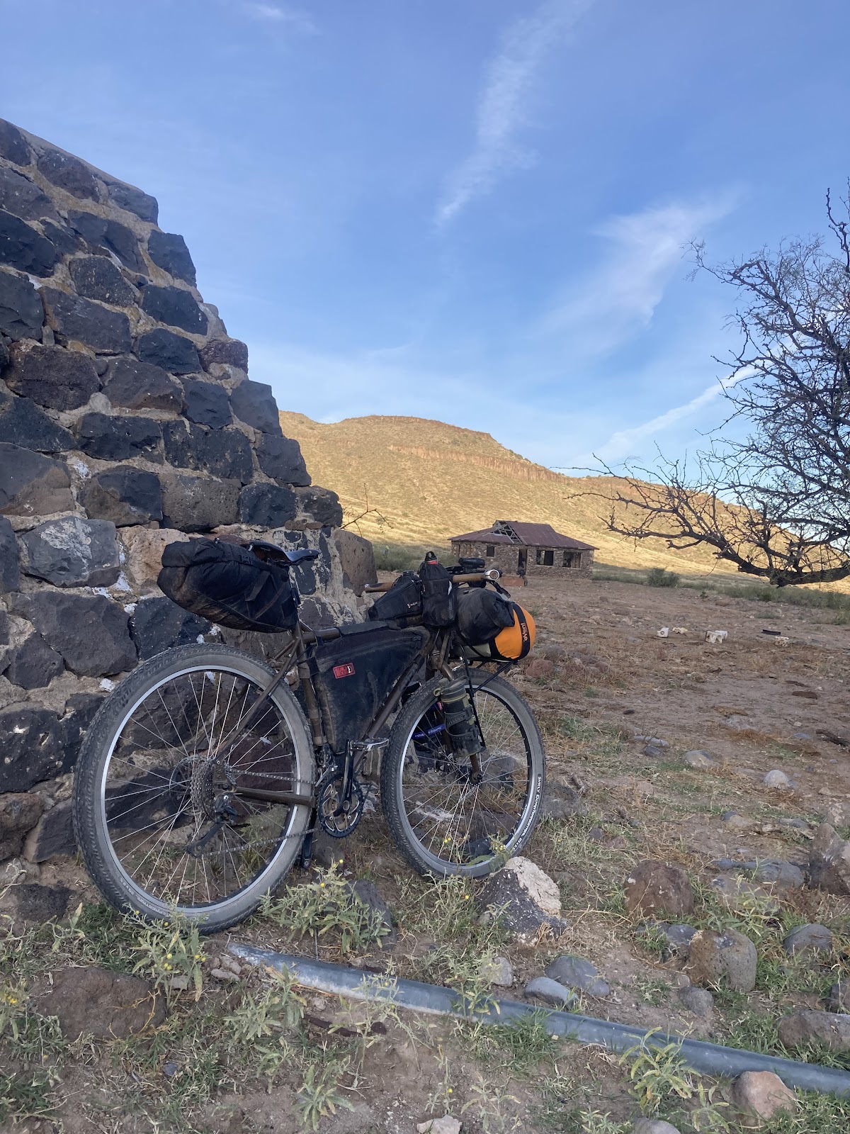
It was a nice little spot to take in the view of the morning sun lighting up the distant hills. White Gap Pass, possibly the most difficult section on the Monumental Loop, also lay a short distance ahead so it was also a spot of mental preparation.
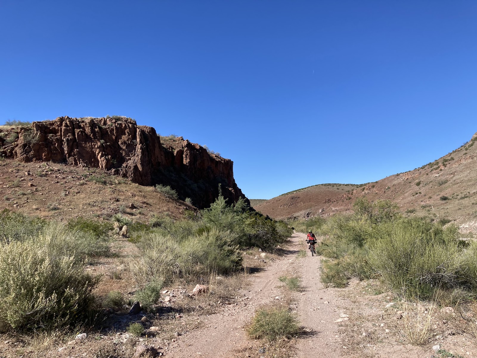
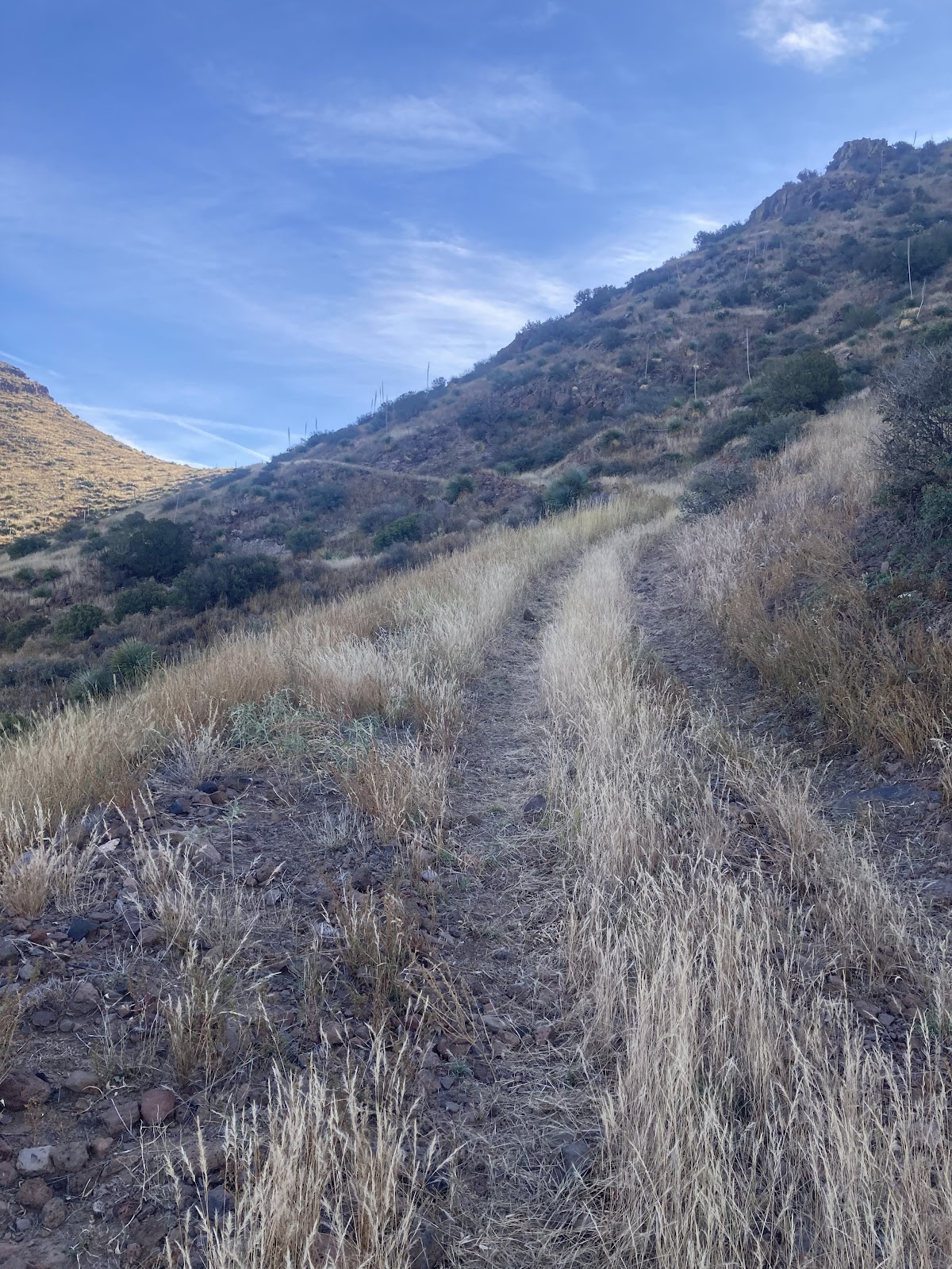
White Gap Pass lived up to the hype. After riding through some low areas with beautiful trees, hike-a-bike, and basketball sized boulders you come to a long bench cut two track scaling the edge of the mountain. Most of this involved taking my bike for a walk.
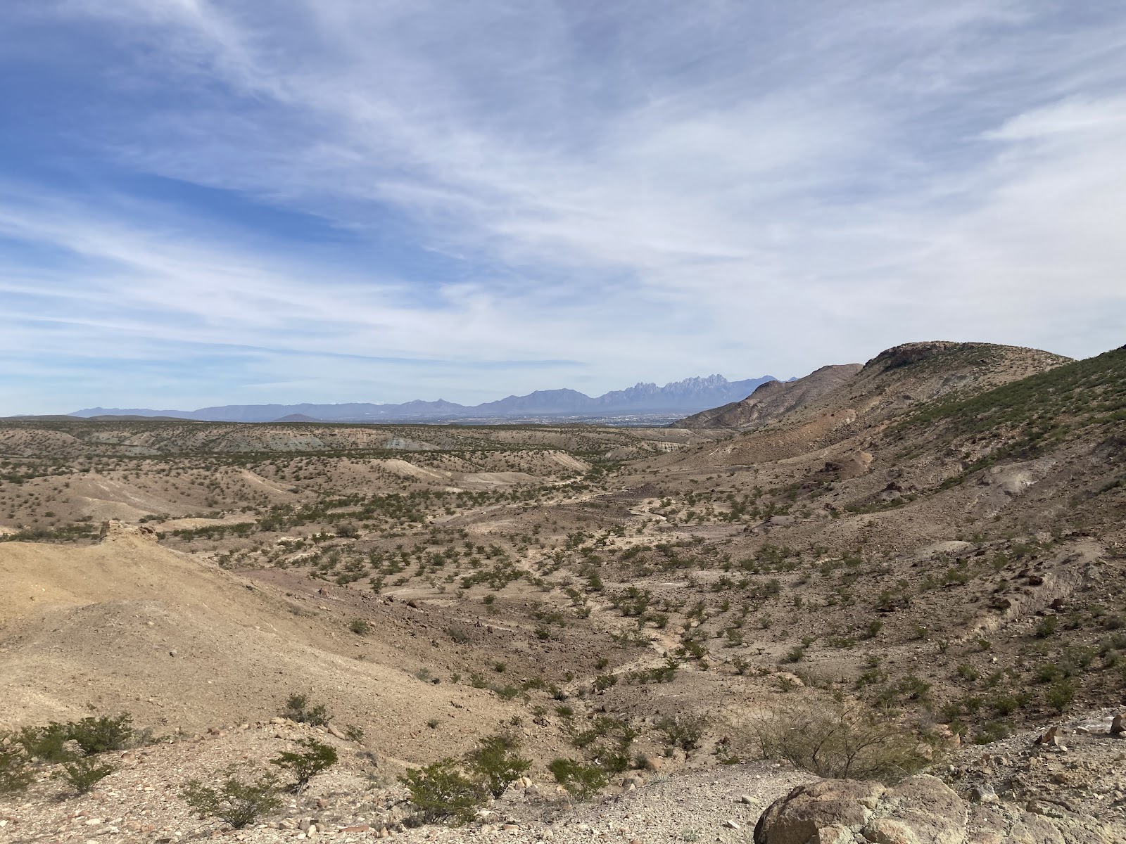
The summit offered incredible views. From Hatch the total climb was almost 2,000 feet and it was the highest point on the route. From here it was a super steep, barely rideable with a loaded bike, descending two-track with loose baby heads everywhere. After riding edges of some cattle ponds and a few other interesting sections in the valley we came to some blacktop and I spot the aid station up ahead. Stopping here we got some great peanut butter and jelly sandwiches and Halloween candy while talking to a couple of great locals running the aid station. They told us that the one person who had been ahead of us yesterday camped at this spot. He was quite a ways ahead of us, maybe four hours. Dave rode the downhill so fast through White Gap that he was also ahead of us. They also warned us of the loose gravel on the asphalt downhills leaving that area. It was super helpful information, although the information was also on the rwgps as a poi, but still a good reminder. As we dropped down out of the high area of white gap it was a very nice down hill and as stated the corners were sketchy. We wanted to tuck and get some speed but really couldn’t. As we got further down we were on a long straight road with some rolling hills before turning off onto a sand road in the basin. I had to walk my bike in some of those sections which was fine by me.

The hot sun beat down on us and as I walked a section a vulture was staring at me from the one lone tree, maybe waiting for me to die. A couple spots in the area following the sand roads were very wet, a condition we had not seen on our trip up to that point. The wet area allowed green brush to flourish. Exiting out of there we climbed a little into a more rocky area. One spot in particular had a nice view of a canyon in Picacho Mountain.
By this point we were right on the edge of town where we popped out into a subdivision and coasted on the asphalt, dropping further down and back into Las Cruces. Looking forward to a nice meal our plan was to go to Chala’s Woodfired Grill but they were closed so we shot up the street a bit further to the Spotted Dog, where ironically a patron had a spotted dog. A good burger with extra fries filled me up and we also had the opportunity to chat with a couple that just finished the south loop.
While leaving the restaurant we discovered Candy’s tire was pretty flat. After closer inspection we saw that the sidewall had a slice from all the rocks we encountered. We had to go back to the car to grab some extra food so while we were there she used the floor pump to get the tire pressure nice and high and then sloshed the Stan’s around with the wheel on its side giving the slash a nice coat of sealant. This seemed to do the trick. Stan’s was oozing out the slice and sealed it up.
The way out of town was to climb up Tortugas Mountain. The path started as a very sandy access road for utilities and then turned to singletrack. On the way up we saw Josh Propfe. Josh just got the FKT on the Monumental Loop a couple weeks back and did it in under 24 hours. He’s a super nice guy and we had the chance to ride with him and McKenzie on the Thursday Gravalerxs group ride. It was great to say hi to him one last time before our trip was done.
After we finished chatting with Josh we jumped onto the singletrack that brought us around the mountain and into a small subdivision. Going through the subdivision was just a short section before getting on more singletrack. The sun was pretty much gone by this point.
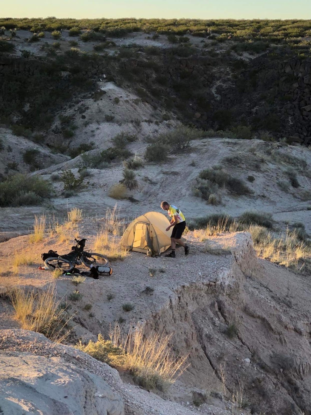
We rode on, the terrain getting more hillier as we were going and although it was dark and hard to say for sure, we were climbing. Another night of looking for a spot to set up tents in the dark. It took until around 8:30 to find a spot we thought was suitable. Candy actually stopped a quarter mile behind me and text me that she was worn down and stopping. I found a nice arroyo to set my tent up in. A nice view of the city below too.

That night I heard some hoof sounds from an animal and heard it push on my bike. Later in the trip someone said it was probably a javalinas which makes sense.
The next morning we had a bunch of singletrack that lay ahead of us. The trail was super fun weaving in and around all the ocotillos, yuccas and prickly pears.
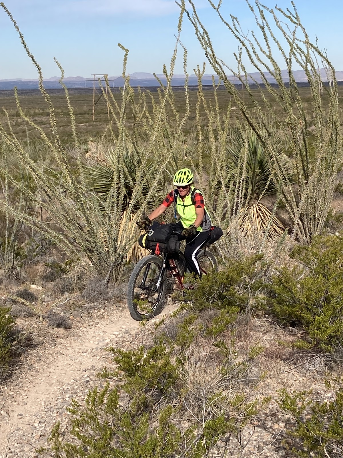
It was my favorite trail on the route. The trail follows the base of the mountains all the way south to Vado. It was on this trail that I picked up a nice size thorn in my tire.
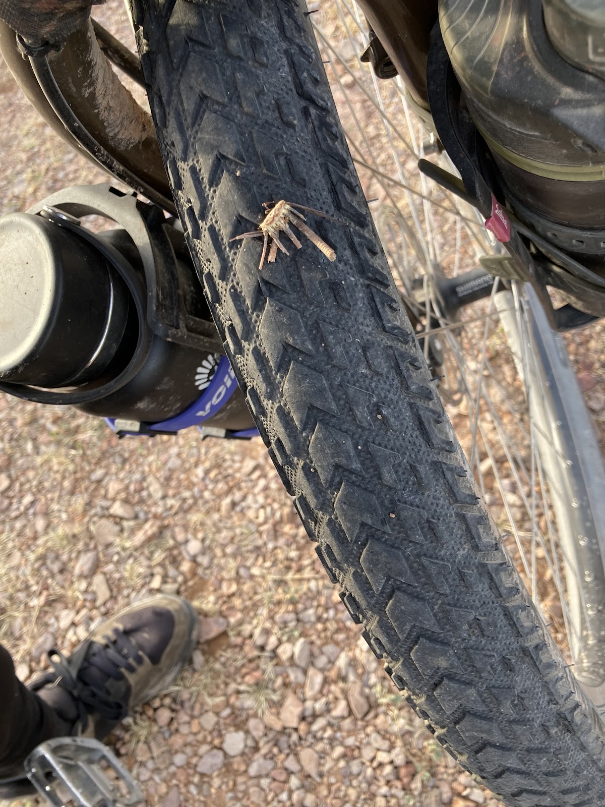
I left it in and just called it a bio plug, a term I learned from one of the locals. A week later and the plug is pretty much worn down and still holds air.
Once we reached Vado we stopped at the first gas station which had a nice selection of fresh fruit. Fresh produce is great while bikepacking!
About a mile or two up the road we came to an incredible food truck.

The people working didn’t know English so we had to communicate using google translate. I got two barbacoa tacos. You could tell the tortillas were homemade. Sweet!

A little further south we went off route and across the interstate to load up on water for our long trip through the desert. The only water that we knew we might have is an aid station that may or may not be open by the time we’d get there so we just were playing it safe. Besides, relying on others in such a harsh environment might be kind of foolish.
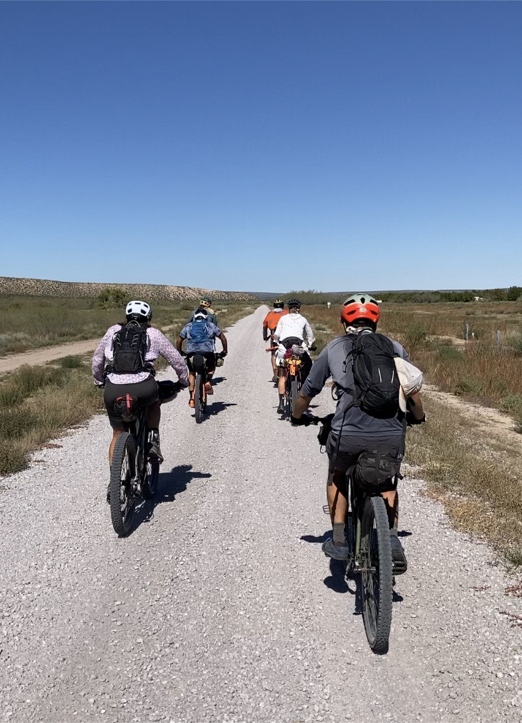
Heading west towards Killbourne Hole meant a small climb into the high desert and more sand roads.

These roads were really fun to ride. Not too sandy, solid base to make good traction. The color was an interesting orange. Getting to Killbourne Hole and camping there was a goal going into the trip. We got there quite early and had a lot of time to enjoy the view, stopping on the southwest end first and then riding up further to where the aid station was marked on Matt’s map.
The aid station was still there and he had plenty of snacks and water and even a keg of beer. We talked with him a while before looking for a nice spot to set up our tents.
Looking at different outcroppings I found a really nice spot to set up.
Shortly after, a large group that we rode with earlier in the week showed up. Henry happened to be riding with that group. It was great to see him one last time! They all set up camp on top of the plateau. In addition to them a group of five women who are local riders were there. We talked with them into the night, the sun setting behind us creating another spectacular display in the desert.

I was especially interested in their role in creating such a bike friendly community. Such things as the ditch riders and the Doña Ana She Wolves and the progression of the bikepacking summit.
The morning brought an amazing sunrise to the far side of the Killy-B-Hole casting shadows that had given the crater a new look. As we departed we said our goodbyes to our friends.
Today would be a bittersweet day. I vowed to take in every bit of desert scenery and at the same time was looking forward to going back to Wisconsin to see my family.
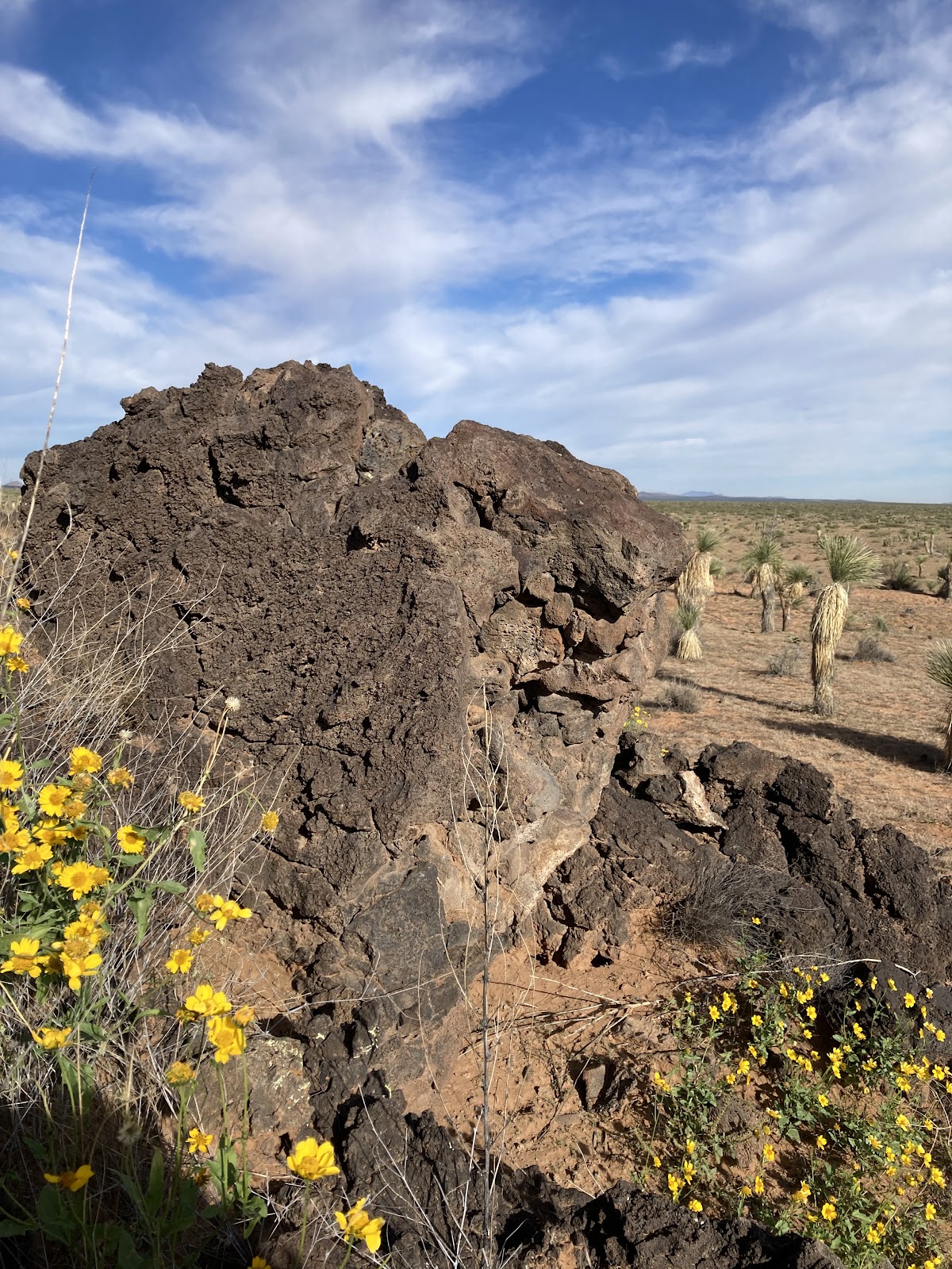
Shortly after leaving the crater we crossed through a cattle gate and into the Aden Crater Wilderness Area. It’s unique and vastly different from the adjacent landscape with its spheres of lava rock. While crossing through the cattle gate we once again crossed paths with Emily. She hiked into the lava rock mounds with us to get a closer look. Some yellow flowers here and there grew from between the lava rocks and yucca growing at the base below. Reminders to us now of an ancient volcano millions of years ago now somehow full of life.
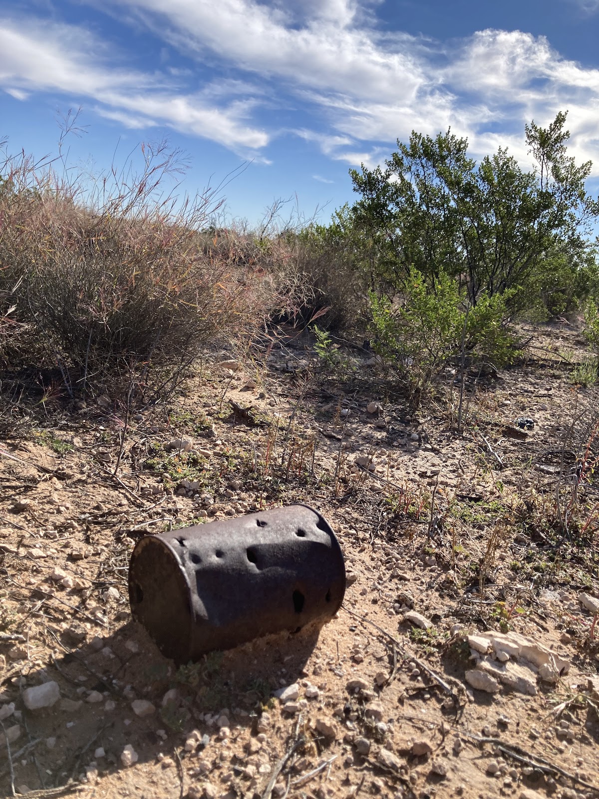
A short cut across the railroad saved us 15 or so miles of pointless ride around, Matt’s words of warning “you might die here, trains are fast though not quiet” running through my mind. After we crossed a train about two miles long did roar through. Remains of perhaps an old train depot lay, only a foundation remaining, along the shortcut across the rails. A metal can that’s been in the desert sun who knows how long lay with a few bullet holes close by the foundation, maybe thrown from the train by an engineer, maybe a can from a dinner from an old cowboy running cattle?
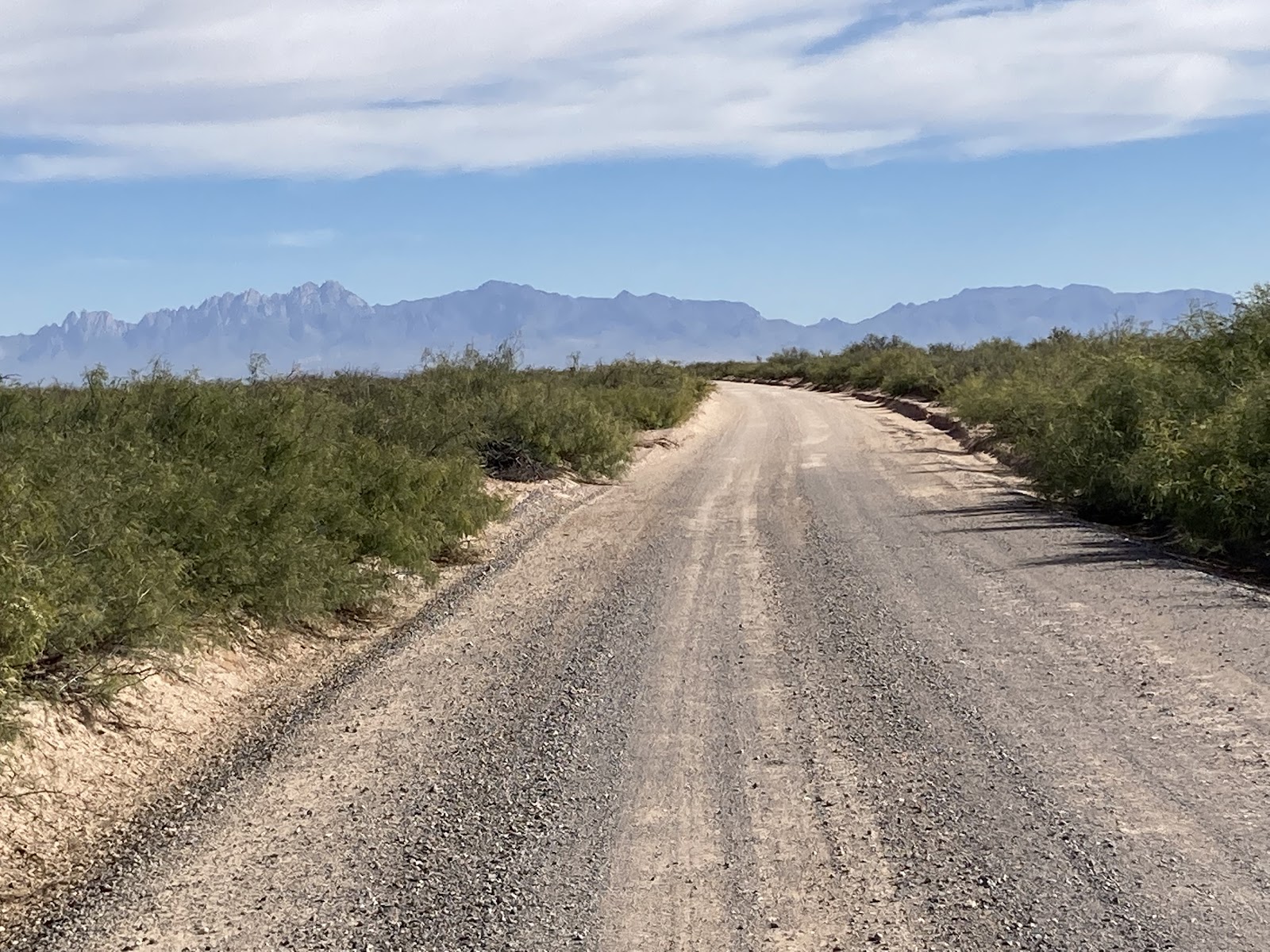
The road leading back to Las Cruces, a long, straight dusty path, deserted of any cars and any sign of life.

As we get closer to the city the Organ Mountain starts coming into view. The easily recognizable sharp peaks, peaks that remind me of the Tetons only void of the snow that’s always present on the Tetons.
Soon we cross the Rio Grande dam, hauntingly empty of water this time of the year, the dam plates look pointless, almost apocalyptic in the dried up state of the riverbed. The riverbed full of beach sand was impossible to ride with my 2.5 tires made me wish I had my fatbike to ride down the riverbed, like fat biking the ice on the river back in Wisconsin.

After crossing the riverbed we start seeing signs of the life filled Las Cruces valley. Rows of pecan trees, alfalfa fields, and cotton. Ditch riding. Dogs barking at us as we ride the ditches behind the farm houses. Slowly the city appears. A nice paved bike path with walkers and cyclists all around soon appears. Such a juxtaposition of where we were only a half hour prior. Las Cruces; full of life, full of community, full of caring people. People like Diego Medina, who told us about the native history of the land during the summit, sweet Grace Hilguin who led all 150 of us bikepackers out of town on her adaptive cycle on Saturday morning, and of course Pablo Lopez and Matt Mason, who, without their vision we all would not be there riding this land. I fully applaud what Pablo and Matt have created down there. There are so many more people we met, too many to mention, who welcomed two Wisconsinites to their city. This is what bikepacking is all about; caring, welcoming and kind cyclists.


Enjoyed your write-up! Curious how you traveled to Las Cruises from Wisconsin as I am considering the ride for next year. I live just across the Mississippi River in Iowa and am trying to figure out travel logistics.
LikeLike
We drove. It’s a pretty easy drive with low traffic. Got there early enough on Thursday to have time to ride the group ride.
LikeLike
Thanks, how long of a drive was it?
I’m considering taking the Amtrak from Burlington, IL to Albuquerque, NM and then there is a shuttle to Las Cruses. But that is a lot of connections. I’ve taken that train route (without bike) before and its a great way to travel to the SW. I know other people who take their bike on the Amtrak.
LikeLike
From here in central Wisconsin it’s 24 hours of drive time. I split it and drive to liberal Kansas and that only leaves me with a nine hour drive on day two minus the roll back to mountain time gets me to las cruces really early
LikeLike